"Of all the mountain ranges I have climbed, I like the Sierra Nevada the best."
The Plan
Originally, the idea was to climb Mt. Whitney, the tallest point of the lower 48 states. However, we were unable to secure permits, and were forced to change plans. We looked a map and decided to hike Major General, a mountain close to Lower Soldier Lake high in the mountains. We left from the Whitey Portal trailhead and headed through Cottonwood Pass to Lower Soldier Lake.
Unfortunately, directly after this trip I realized I had lost my Nikon and all of my pictures that were on the SD in the camera. The pictures in this post are what I took with my phone, so please excuse the lower quality images.
A section of the PCT
Hiking the PCT or JMT (Pacific Crest Trail / John Muir Trail) is on nearly every backpacker’s bucket list. Each are quintessential backpacking trails on the West Coast and consistently listed as top five in the entire country when raking long distance backpacking treks. The major concern for both of these treks, however, is the time commitment needed to complete the entire thru hike. Very few of us can afford to take up to a month off for the JMT and five months for the PCT - no matter how amazing they may be.
Luckily for us backpackers with more traditional careers paths there are ways to hike the trails without having to quit or day-to-days. Along the stretch of both treks, there are various shorter hikes, usually the perfect length for what we call a ‘section hike’ of the full thru hike. One of these section hikes is Cottonwood Pass to Lower Soldier Lake. Five of the exquisite ten miles of the trail are shared with the PCT and give you a sense of ‘a day on the trail’ of the mighty hike. Additionally, Cottonwood Pass guides you through some of the loveliest paths in the Sierra Nevadas, and Lower Soldier Lake is seated in the far east corner of Sequoia National Park just a stone's throw away from Mt. Whitney, the tallest mountain in the lower 48 states.
Mt. Whitney
Originally hoping to hike Mt. Whitney, we stopped at the small town of Lone Pine, California, to pick up the proper permits. Hiking Whitney is hugely popular, especially during the summer months. A way to combat the large crowds was to issue a set number of permits per day, trying to be fair, the rangers us a lottery system to issue the permits. Each morning, the rangers put names into a hat a pull a certain number of permits for the day. We were not the only ones hoping to climb the mountain that day, and it was unlikely that all four of our names were going to be pulled, so we gave up place to another group with similar ambitions.
Making new plans are part of almost every single trip I have ever been on, so we were too beat up about the change in schedule. Instead, we asked the rangers for a suggestion for an alternate hike in the area. They must have pitied us, because we had driven across the country from Pennsylvania to hike in the mountains because the ranger’s suggestion ended up being on the best hikes we had ever walked.
Cottonwood Pass
From the streets of Lone Pine, miles away from the base of the mountains, the peaks looked intimidating. It wasn’t until we started the drive up Horseshoe Meadow Road did we realize just how high we were heading. The trailhead started near the Horseshoe Meadow Campground, high into the mountains, and the contrast in elevation was staggering. I was remarkably thankful the road went as high as it did, because if the trailhead stated at the base of the mountain we might not have ever made it to the top.
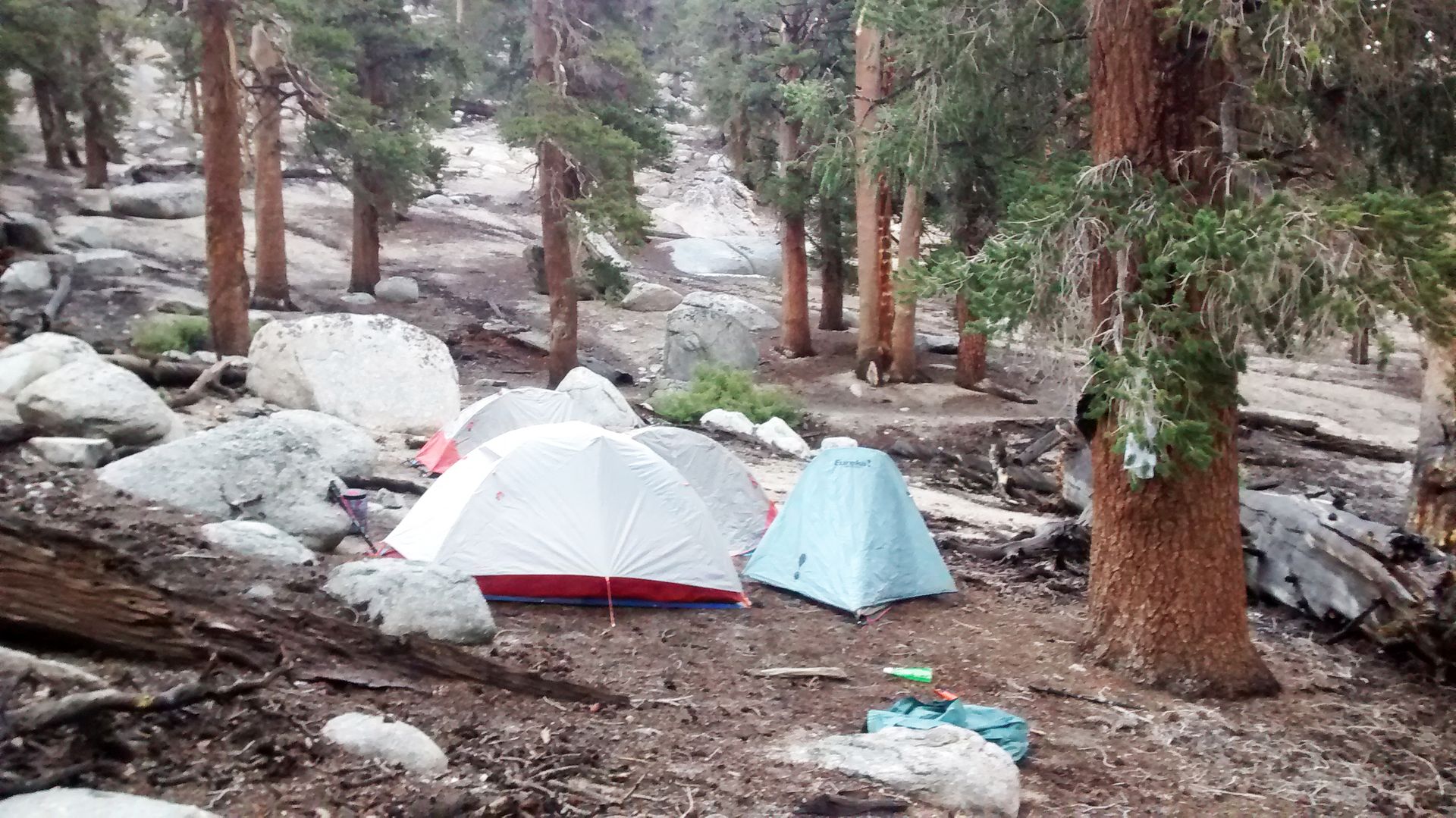
From the trailhead, the first mile is relatively easy, however, as soon as we set foot on the trail hail began to bombard us and didn’t let up until we set up camp for the night. We also, as per usual, had a late start to the hike, only giving us a few hours until sundown.
Still being in the Golden Trout Wilderness by nightfall, we followed wilderness rules and set up camp 100 yards from the trail - or so we thought. The heavy hail had coated the ground in slick ice completely obscuring the trail. It turns out they we were pretty far off the trail most of the previous day, and discovered our mistake early the next morning when two gentlemen walked right between our tents the next morning. Once the ice melted we found that we had set up directly on the trail, oops.
The men, who were hiking super early in the morning, gently woke us up to inform us that we were slightly in the way. Instead of leaving, they sat down and joined us for a cup of morning coffee. They proceeded to tell us one of the most fantastic stories I have ever heard on the trail, which involved lost friend, downed airplanes, and a life long mission. You’ll have to read my book to get a full story to that one.
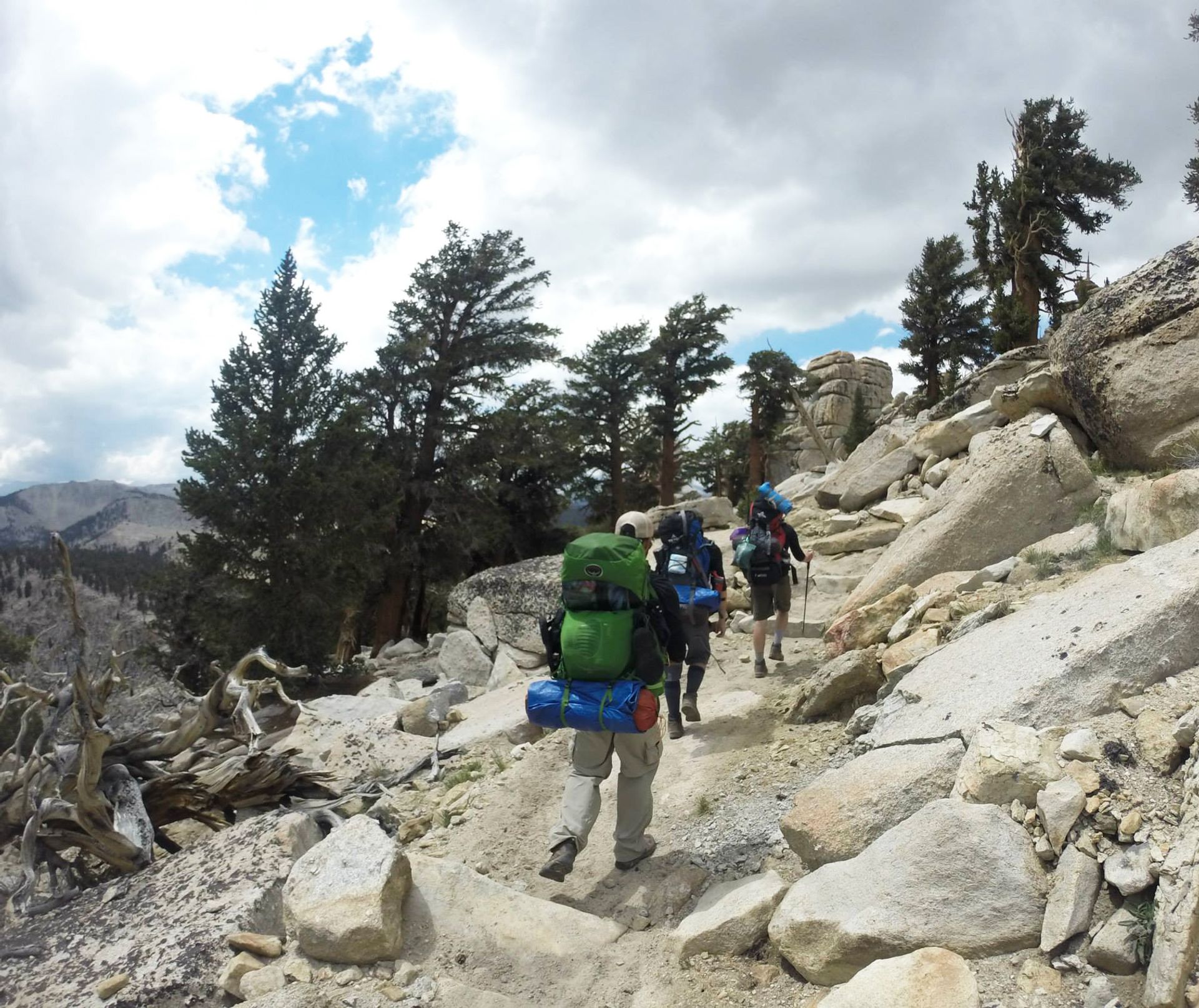
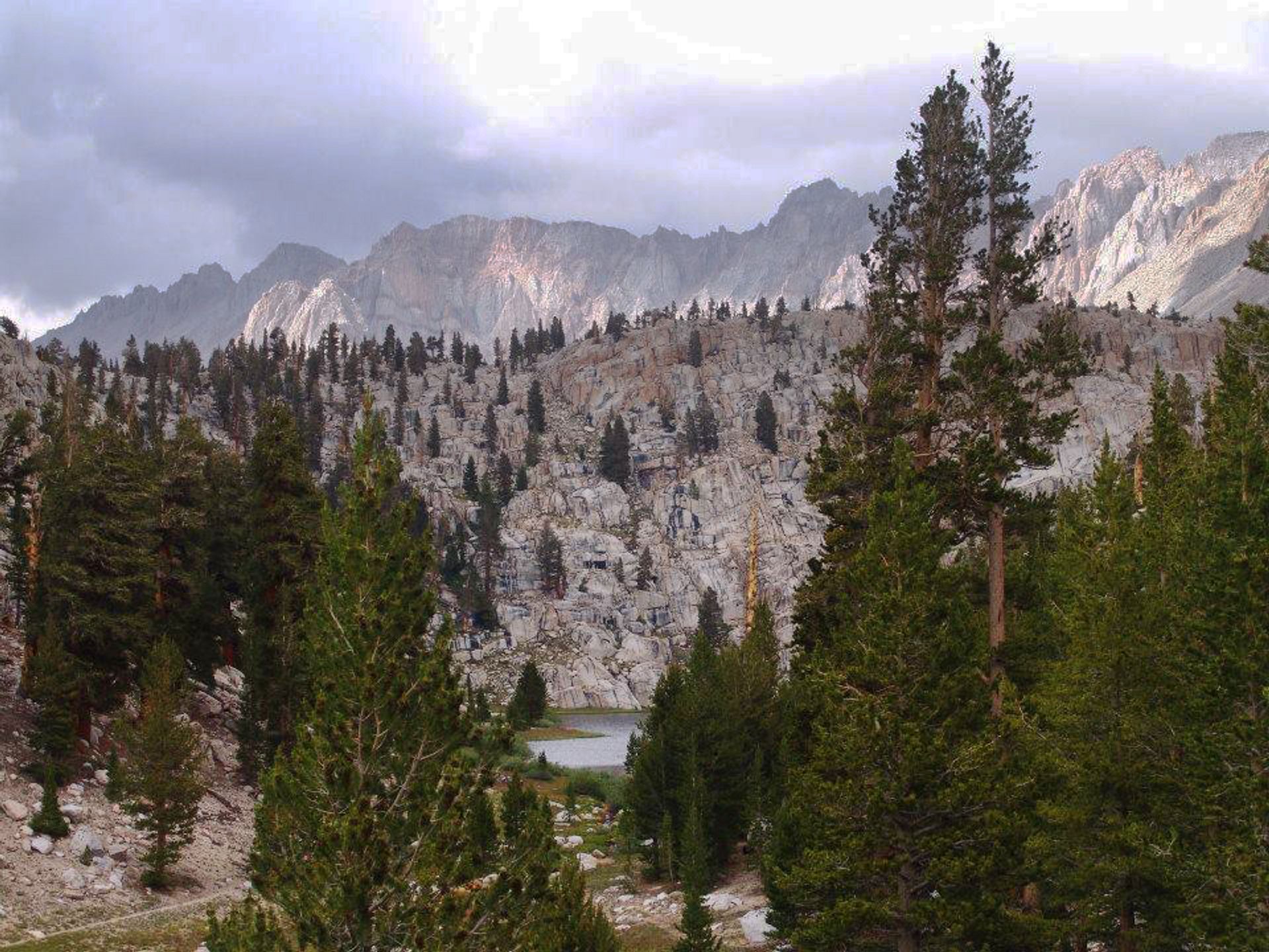
We hiked with the men for a few miles and eventually split just before Cottonwood Pass. Then followed the trail up and over the Pass itself. The top of the pass signifies a few imaginary lines. It is the dividing point for the Tulare and Inyo county lines, as well as a junction for Cottonwood Pass trail and the PCT, which is also a section of the JMT. For the next five miles, you might run into a PCT or a JMT hiker - we ran into a few of each.
Lower Soldier Lake
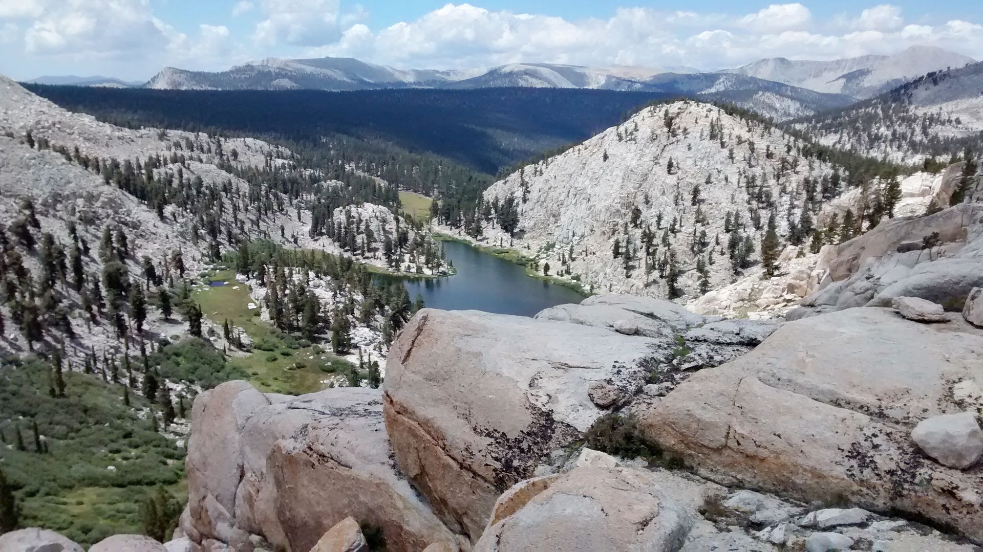
Shortly after crossing into Sequoia National Park (which I can’t recall if there was a sign indicating that) you will veer off the PCT and head north towards Lower Soldier Lake. The trails were well used, with the area being a popular destination for overnight hikers, so don’t worry about losing the path
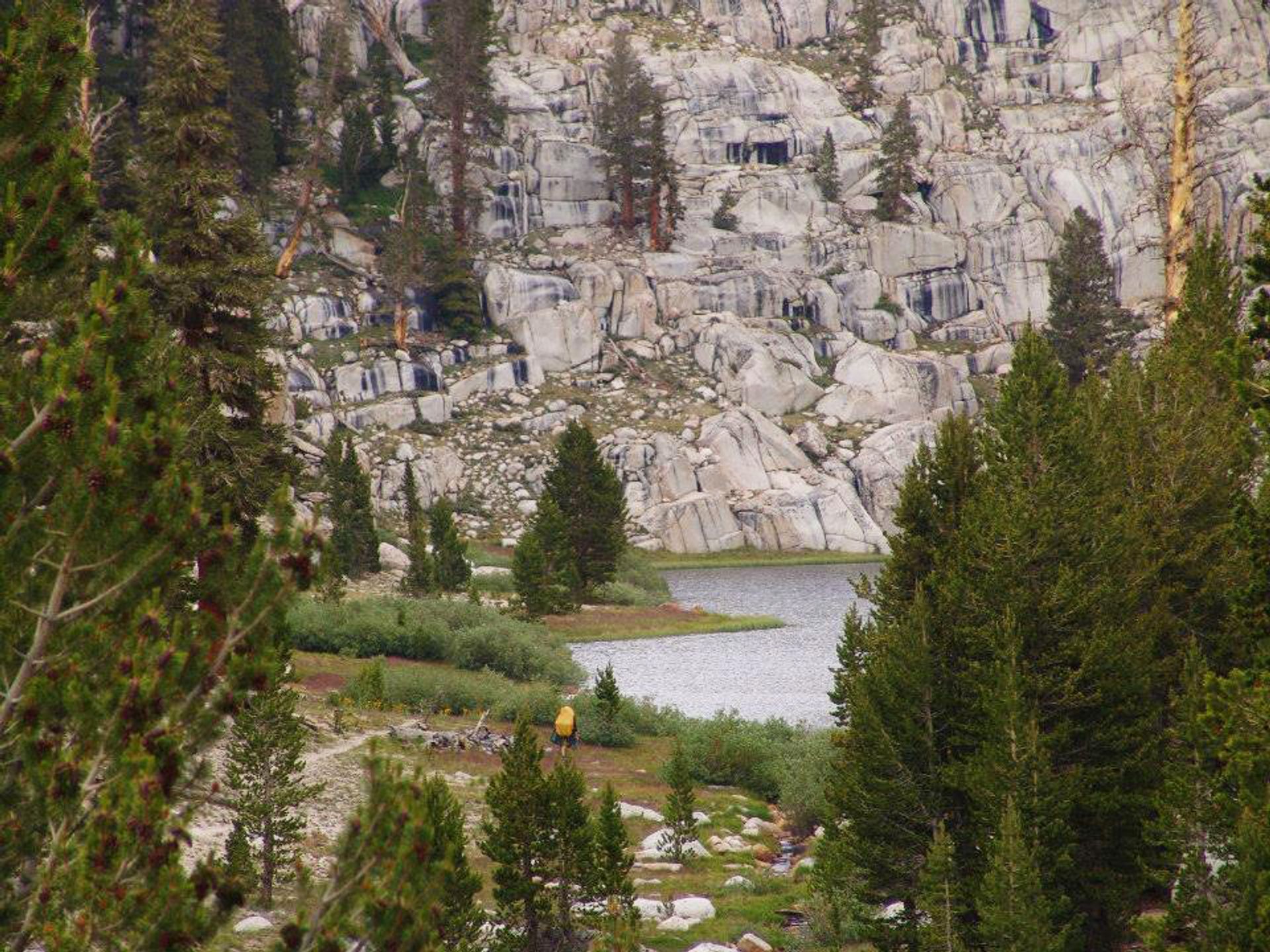
LSL is a beautiful example of a Sierra Nevadan, alpine lake. The water is cool and clear, so clear that you should be able to see trout swimming between the reeds. There is plenty of room to find a campsite, just remember to stay away from the lake and off the trial. Since this is a national park, a backcountry permit is required to stay the night.
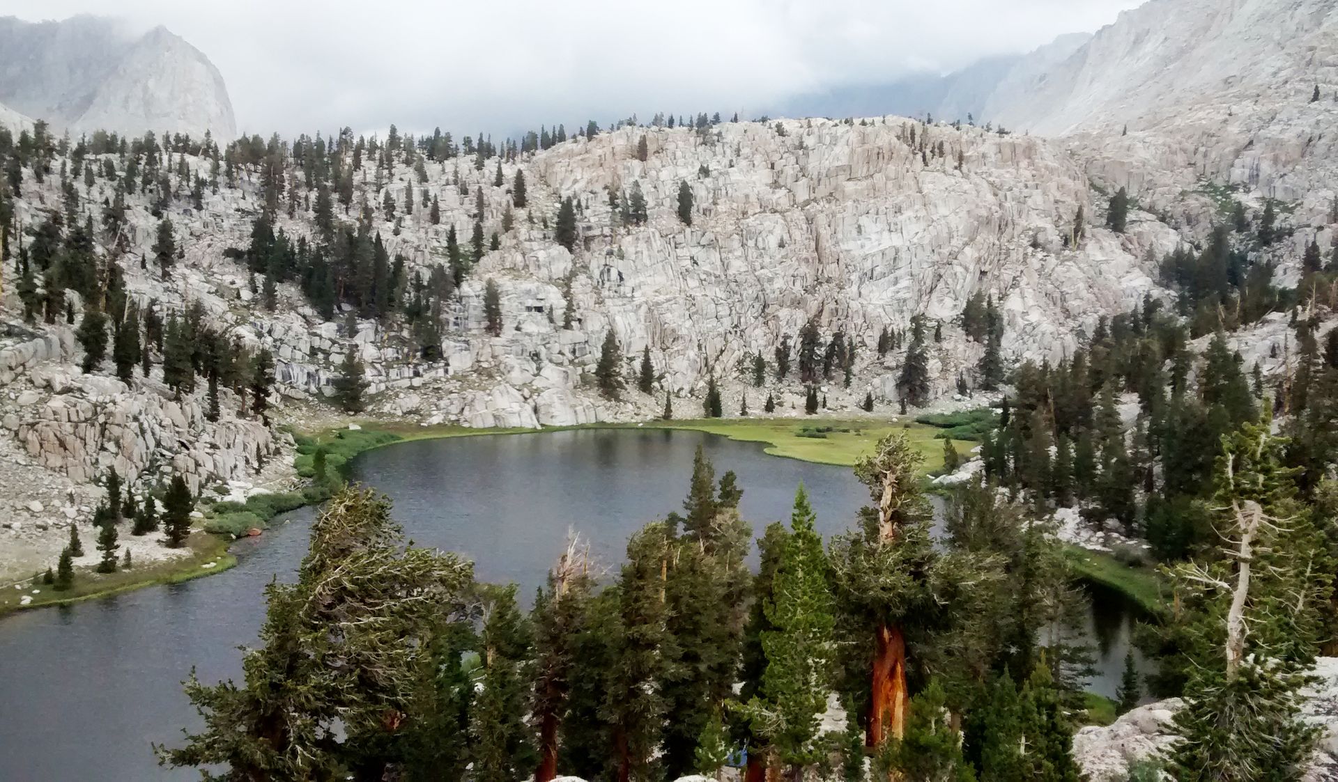
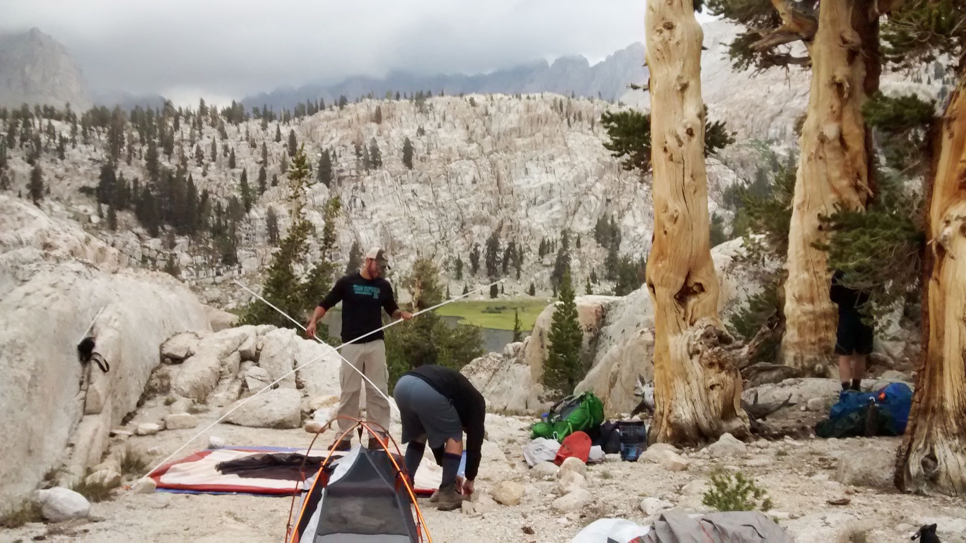
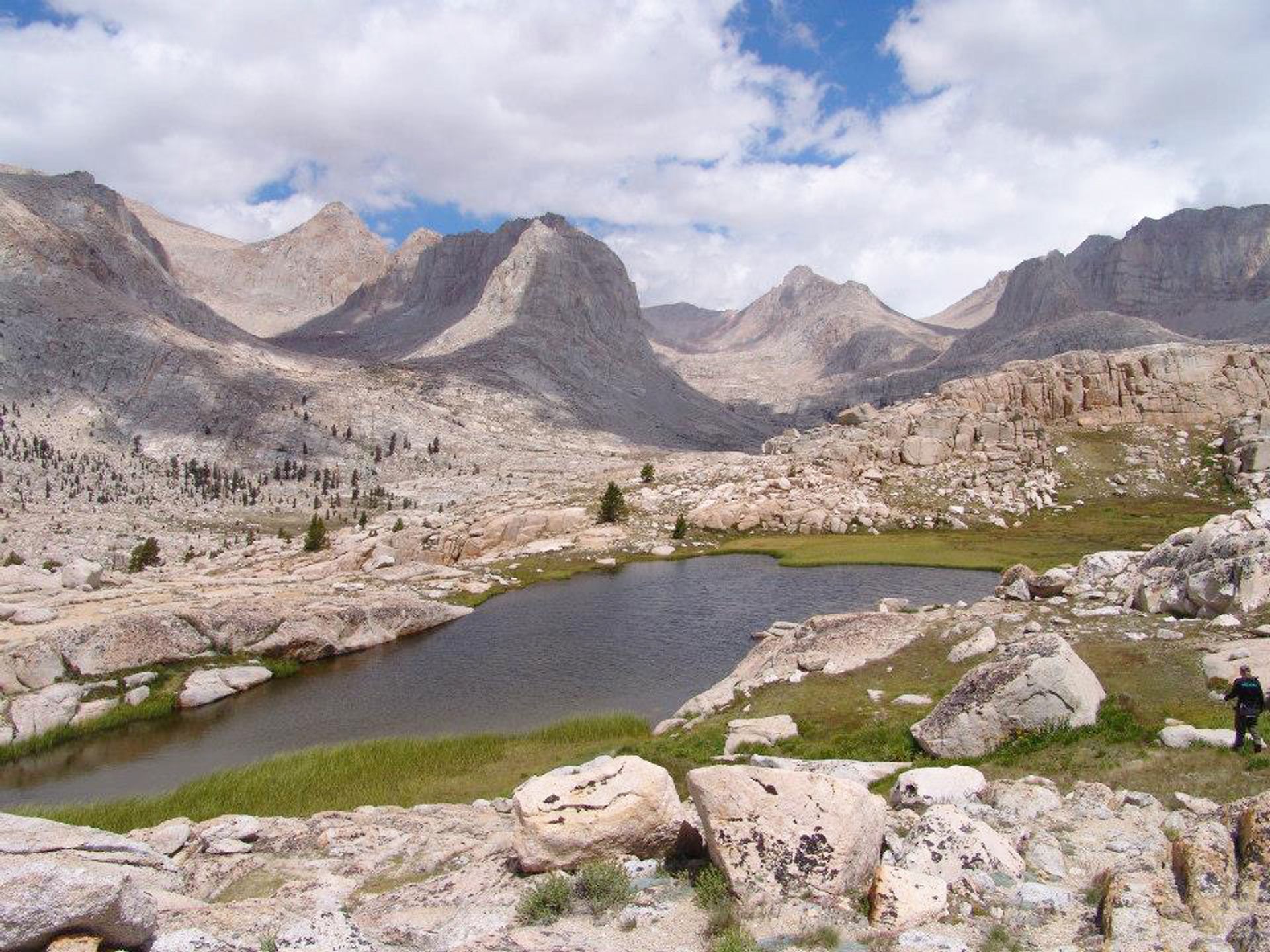
We camped on the the little hill that overlooked the lake. We had a beautiful view of the surrounding area, and the mountain we planned on summiting the next morning - The Major General.
While looking for a campsite, we met the only other backpackers in the area. They claimed Lower Soldier Lake was their favorite spot in the mountain range, and told us they come every year. They suggested that we climbed to the top of Major General, a large mountain that sat directly on the other side of the lake.
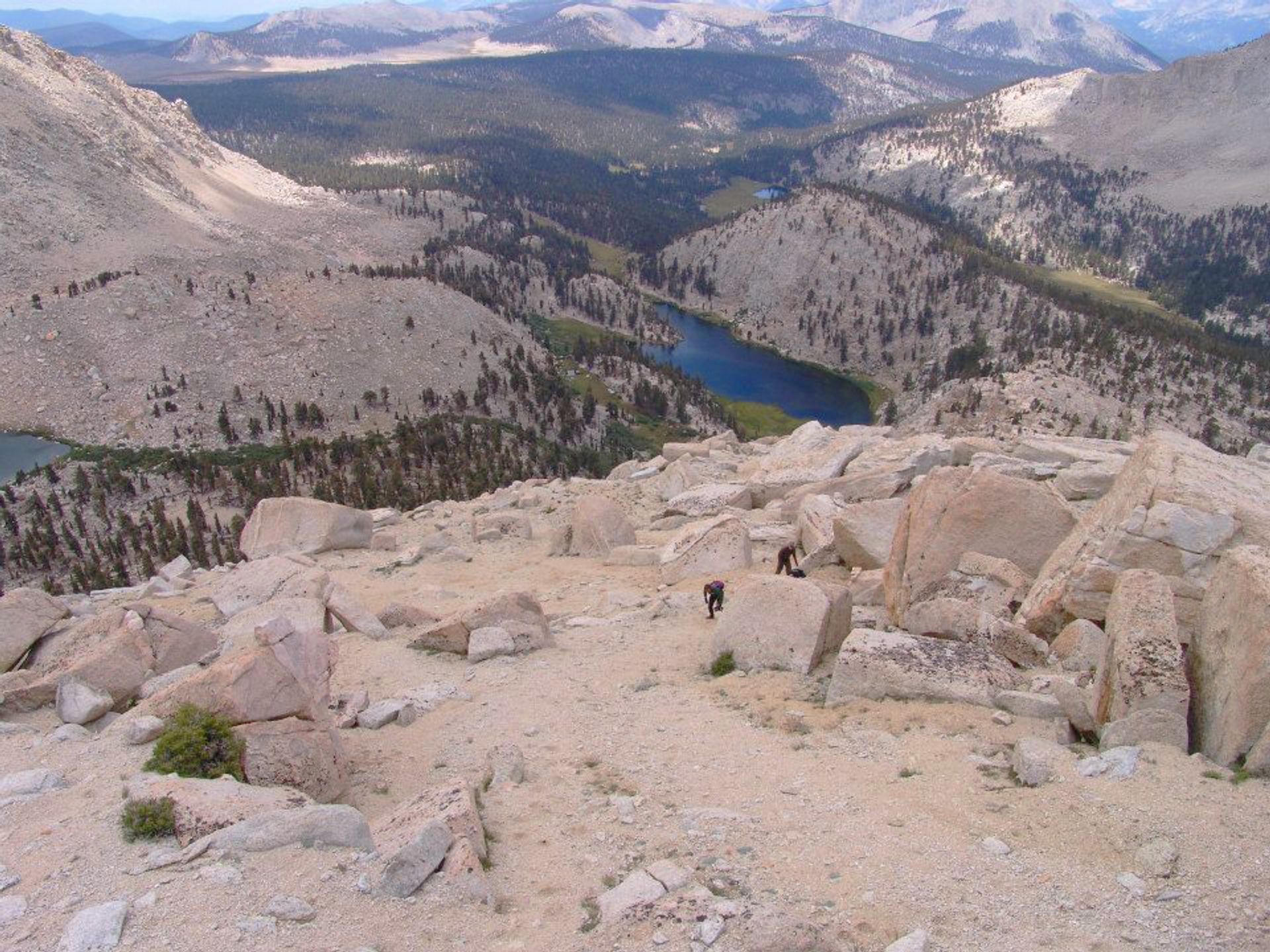
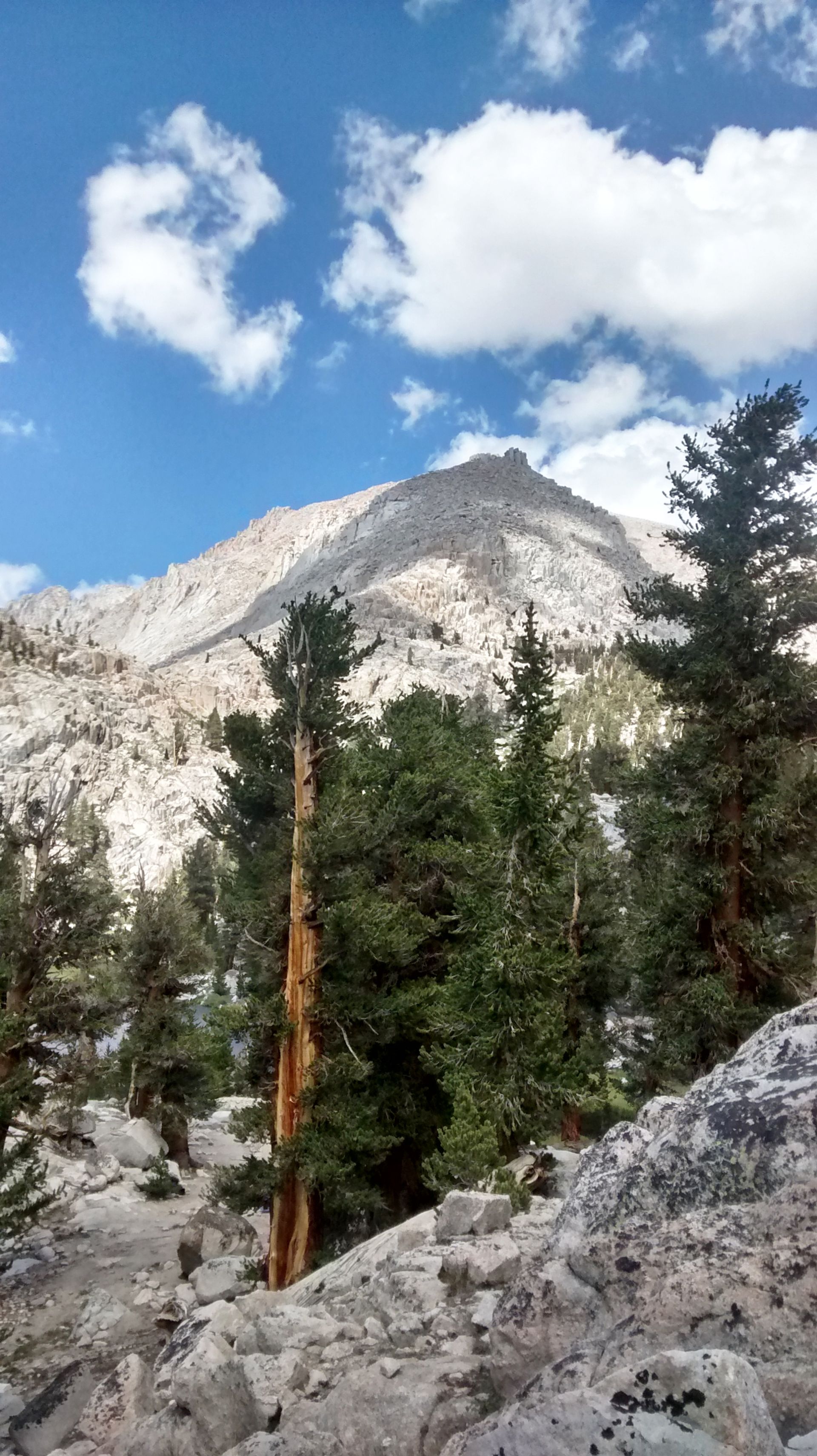
Like all other mountains, from the base it didn’t look too tall, but once we started climbing we realized it was going to take most of the day. I believe it was almost two thousand feet of elevation gain, with the lake sitting around 10800 feet and the summit of MG at 12400.
After a few hundred feet of climbing the slope leveled off revealing another, smaller lake, and a bouldery basin. Each surrounding mountain had a valley at it's foot, and each valley held a small pond. The scene was a new world to us, we couldn’t even see it from a few hundred feet below
From there, the scramble began, and didn't stop until we were standing at the top of the mountain. The Major General may be my favorite summit to-date, it certainly was the most ‘fun’. There is no established trail to the top due to its relative gentle incline and openness - you choose your own way to the top, making the summit a unique experience for everyone.
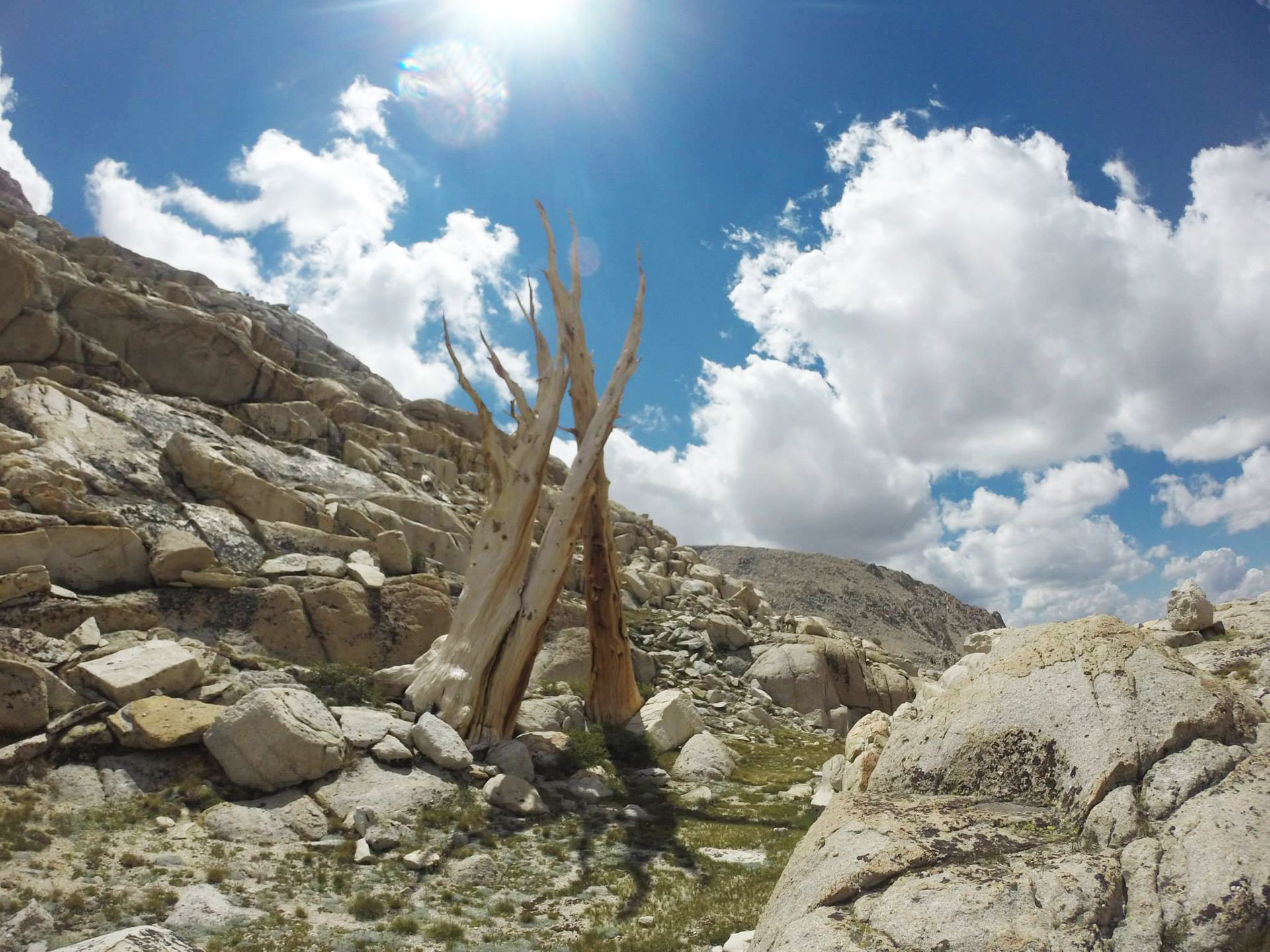
It turns out that Major General is almost a pseudo-summit for Mt. Langley, the second tallest mountain in the Sierra Nevadas. Langley sits a thousand feet about the Major, and is in clear view at the top. Simply thinking of the view at the top of MG gives me chills to this day. One the way down, we found three trees far above the treeline, interlocked in some ancient struggle for survival.
Back to Lone Pine
Hiking in the Sierra Nevadas was literally a dream come true. Just a year before making this trip, I watch the documentary Mile, Mile and a Half, which highlighted the JMT. As soon as the credits began to roll, I promised myself I would follow in their footsteps and hike the pearly mountains.
The Major General signified not only the end of our trip in California, but it was the conclusion to a self-made promise. The summit was also proof that a student, with very few financial means, could explore and have an adventure. It proved to me that I didn’t need to follow in my friends footstep and spend my entire savings to spend one week in Europe - adventure was waiting within my means. And I think I got a better story out of it in the end.
"All the world lies warm in one heart, yet the Sierra seems to get more light than other mountains. The weather is mostly sunshine embellished with magnificent storms, and nearly everything shines from base to summit - the rocks, streams, lakes, glaciers, irised falls, and the forests of silver fir and silver pine."