Quick Note
I always start my entries with a quote that summarizes the location being discussed and my feelings of the area. Often times what I am trying to say has been articulated much better by someone much smarter. However, when it came to Pennsylvania, I could not confidently find a quote that did the state justice. More has been said about Pennsylvania Avenue in D.C. that about the state itself - which is a tragedy because Pennsylvania is beautiful and bursting with history and character.
Pennsylvania
Pennsylvania has been described to me by out-of-staters as “Pittsburgh and Philadelphia with Kentucky in the middle.” I honestly can’t argue with that claim. Though, if they meant it as an insult, I took no offense, because I am quite fond of Kentucky.
After living most of my life in Pennsylvania it's hard to say for certain what exactly we are known for. Probably something between our pacifist Amish community and our insane sports fans, but I also don’t think of Pennsylvania as a fly-over state. However, I can confidently say there is a LOT more to PA than Philadelphia and Pittsburgh. The Keystone State is blanketed from tip to tail in forest-covered hills, cascading waterfalls, and beautiful small towns.
Unlike the open west, where you can see all the mountains and attractions from miles away, Pennsylvania hides its wonders deep in her dark forests. You have to know where to look if you want to find the spectacular. There is very little federal land in Pennsylvania, but the state owns and operates over 2.2 million square acres of forest services and state parks - all available to the public. One of these areas is the Loyalsock State Forest.
Loyalsock State Forest
Other than a funny name, Loyalsock State Forest is a prime example of the natural beauty Pennsylvania has to offer. Located just over an hour west of Scranton, the Loyalsock forest sits between, in my opinion, two of the best state parks in Pennsylvania; World’s End State Park, and Ricketts Glen.
The area is so beautiful, in fact, that Ricketts Glen was on track to becoming a proper national park, but due to funding issues surrounding WWII the plans were scrapped and the state bought the land instead. It would have been only the second National Park in the entire Mid Atlantic region, the other of course being Acadia in Maine.
Both World’s End and Ricketts Glen are prime examples of the Pennsylvania wilderness, and the Loyalsock Trail is one of, if not the, premiere trail that proves that claim. While the Appalachian Trail does pass through Pennsylvania, it can be argued that the area it goes through isn’t quite an accurate representation of what PA has to offer.
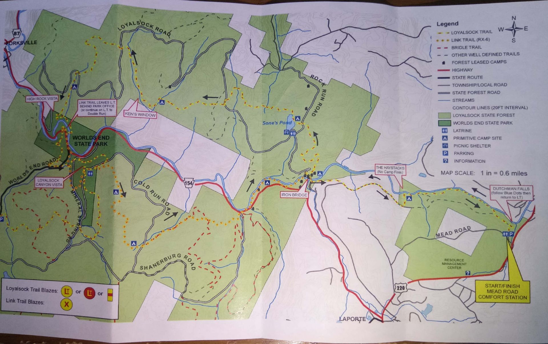
The Loyalsock trail is a 60 mile trek through the heart of PA, but if you don’t have time for the whole through hike, there is the option of the Loyalsock Link Trail Loop. The Link Loop is around 25 miles and perfect for a long weekend trip.
The Loyalsock Link Trail Loop
Four years ago the Loyalsock Link Trail became my first experience with backcountry backpacking. Since then, I have hiked and backpacked in nearly every state, finally, last week, I returned to my first trail once again.
For years, I used my trip in the Loyalsock forest as a gage to judge the difficulty of other hikes. I always remembered my first trip being tough, long, and exhausting. I was excited to come back and see how I have grown as a hiker with an extra thousands miles on the trail.
Additionally, despite growing up in Pennsylvania, I didn’t get into the sport of backpacking until I left the state. PA remains one of my least explored states in the US, and I was happy to finally give a state I love so much some attention.
Where to Start
The Loyalsock Link has a few options on where to start. I always start at the World’s End Visitor’s Center. Here I can stop in at the station and ask about trail conditions and required permits before I head off. No permits are required for hikers on the Loyalsock Trail, but is still good to double check. Also, you can snag a free parking permit from the station.
I also wanted to give a shout-out to whoever names our country's recreations areas. World's End is an awesome name for a park. It tops the charts with other fantastic names such as Never Summer Wilderness, Death Valley, Craters of the Moon, and Land Between the Lakes.
It is slightly debated where the name World's End originated, but there are two leading theories. The first is that seven small mountain ranges converge in the park giving it the 'end' of the ranges and a final conclusion to the hills. The second theory is that the park was originally called Whirl’s End, due to there supposedly being a large whirlpool in one of the rivers within the park. Unfortunately, the whirlpool is no longer there, so we’ll have to settle on World’s End.
Depending on what kind of person you are, you can either save the best for last, or steam through it right off the bat. I prefer to end a hike with a bang (and downhill!) rather than a tough uphill battle and an uneventful conclusion.
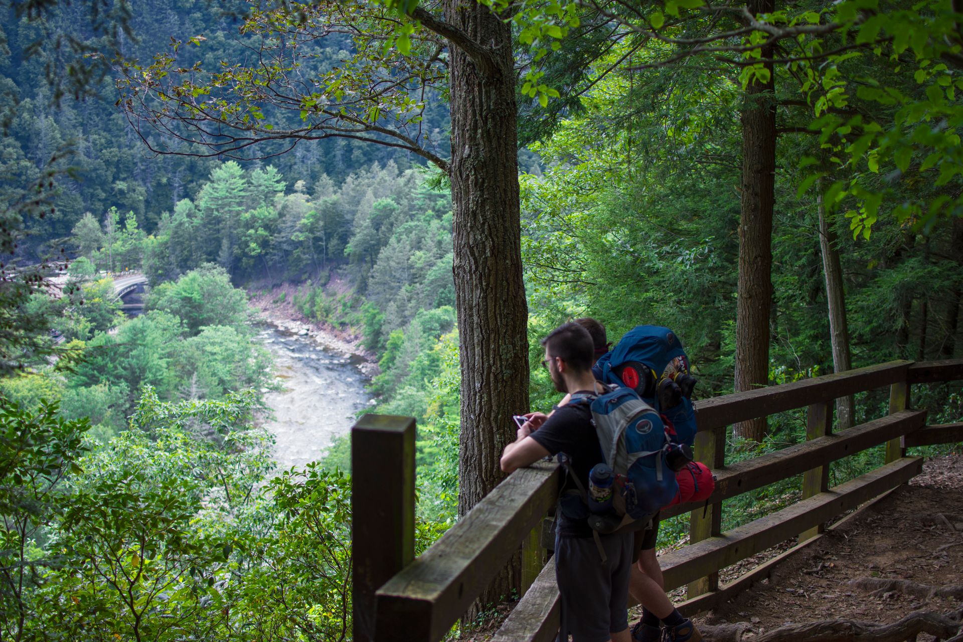
If you are like me, then start the trail at the High Rock Vista trailhead. Leaving the Visitor’s Center, walk down the dirt road a few hundred yards over a bridge. To your right, you’ll find a small parking spot with a trailhead. It starts with significant elevation straight up and past the High Rock Vista and into the Loyalsock forest.
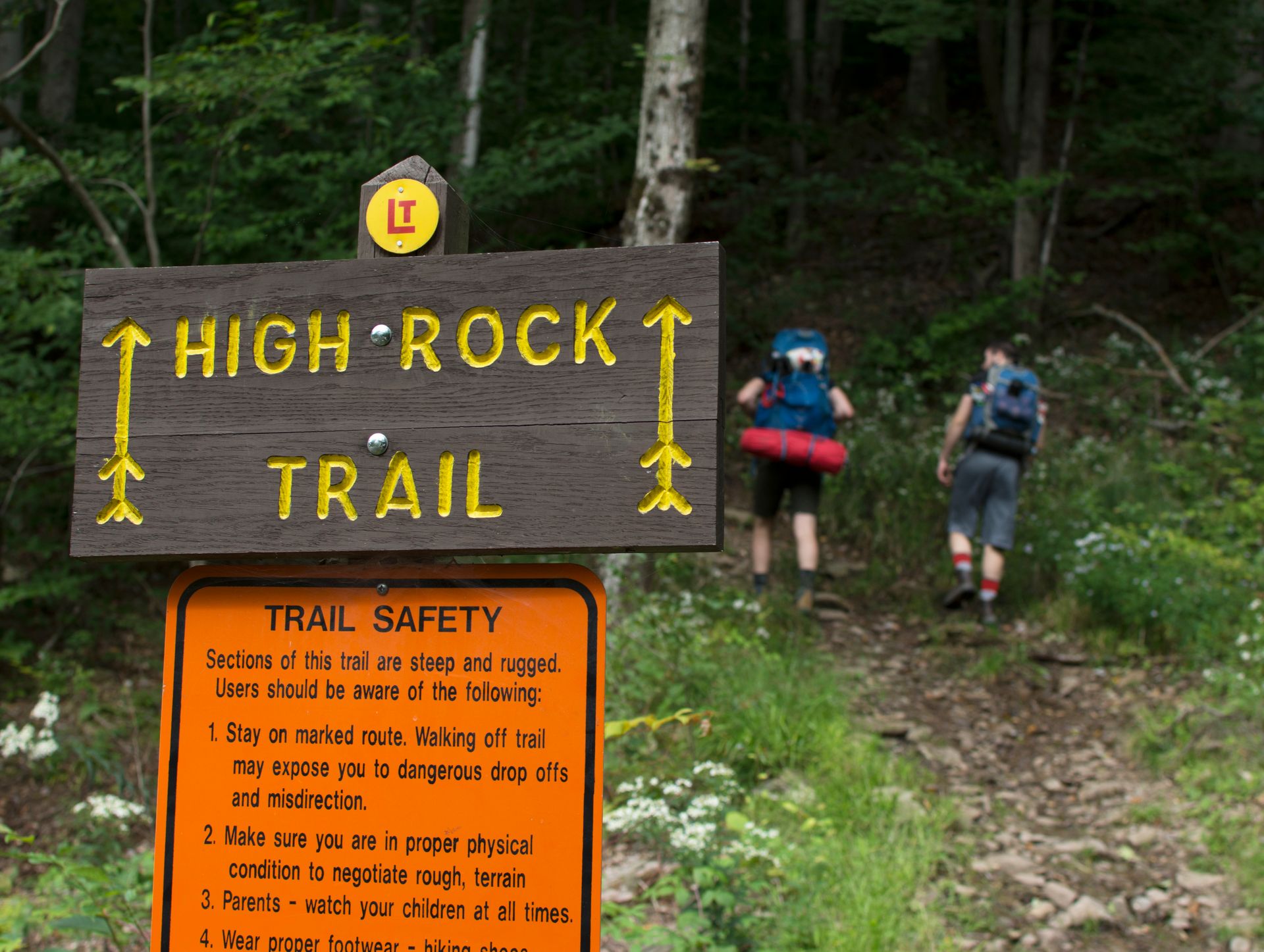
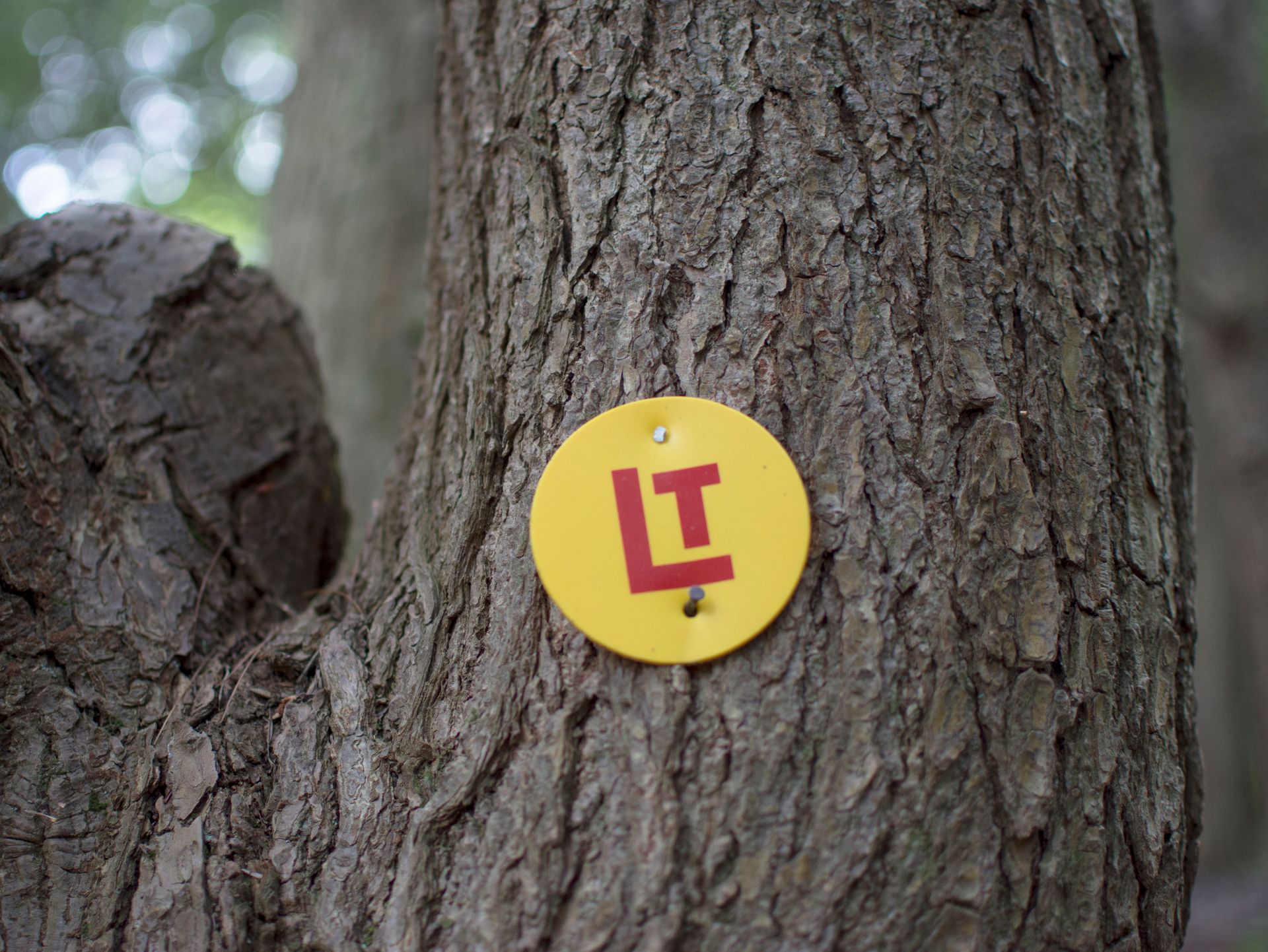
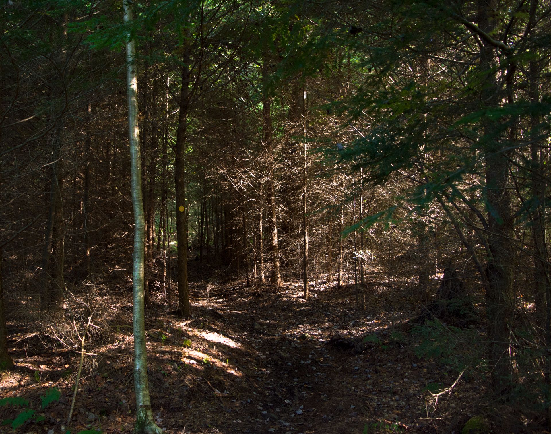
The Loyalsock Trail or LT is remarkably well marked. Bright yellow LT canning lids are on trees eye level every fifty feet or so, however, you still need to pay attention; we walked off the trail two or three times, due to heavy underbrush.
World’s End Visitor’s Center to Sone's Pond
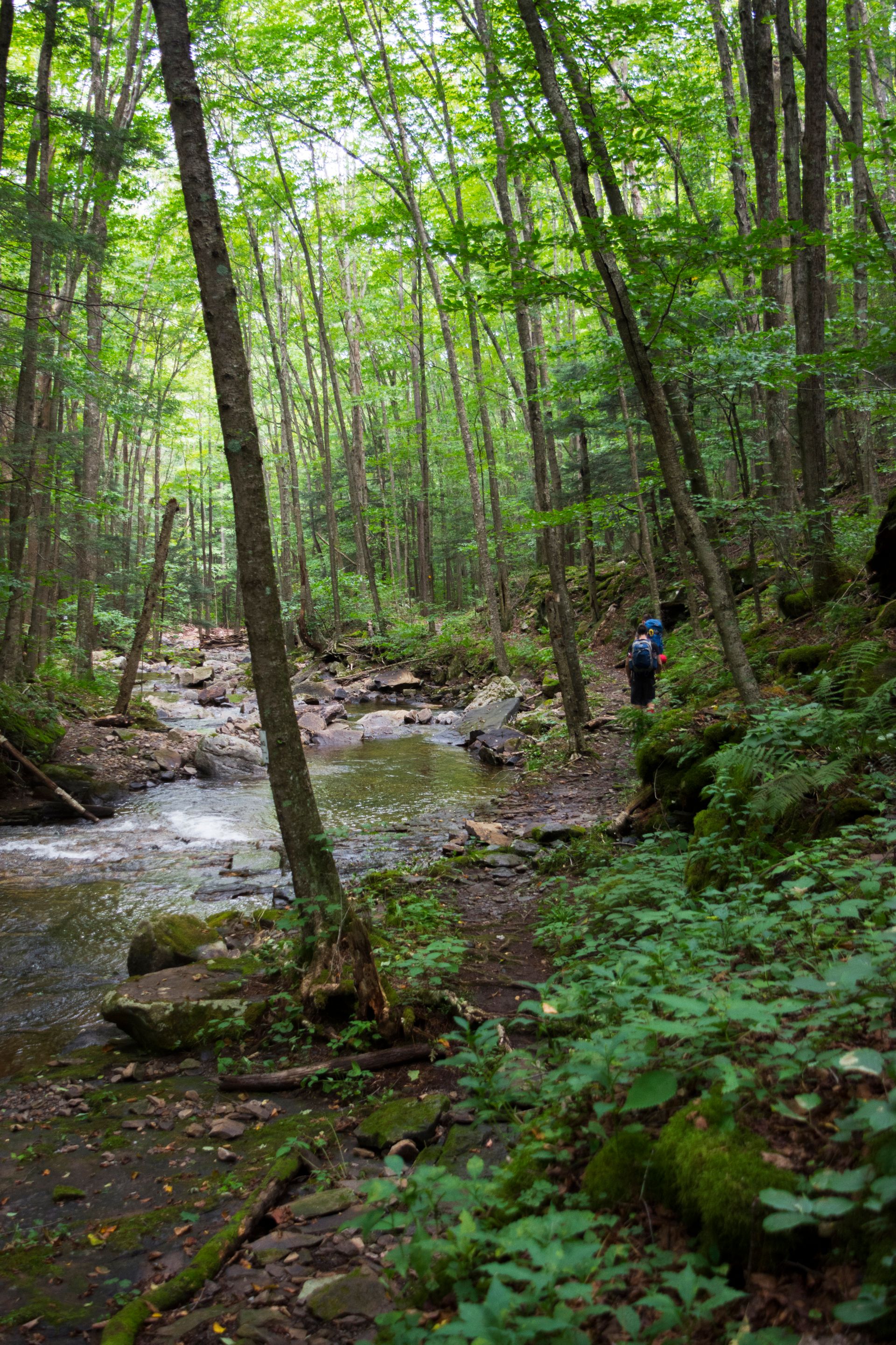
Following the Loyalsock Trail, you will go up and down the side of several hills, it's a surprising amount of elevation change. Out West, you tend to hike high into the mountains and then stay at that elevation for several miles, in Pennsylvania, there are thirty humble hills in the place of one mighty mountain. The LT starts off with a steep climb right up the side of a small creek.
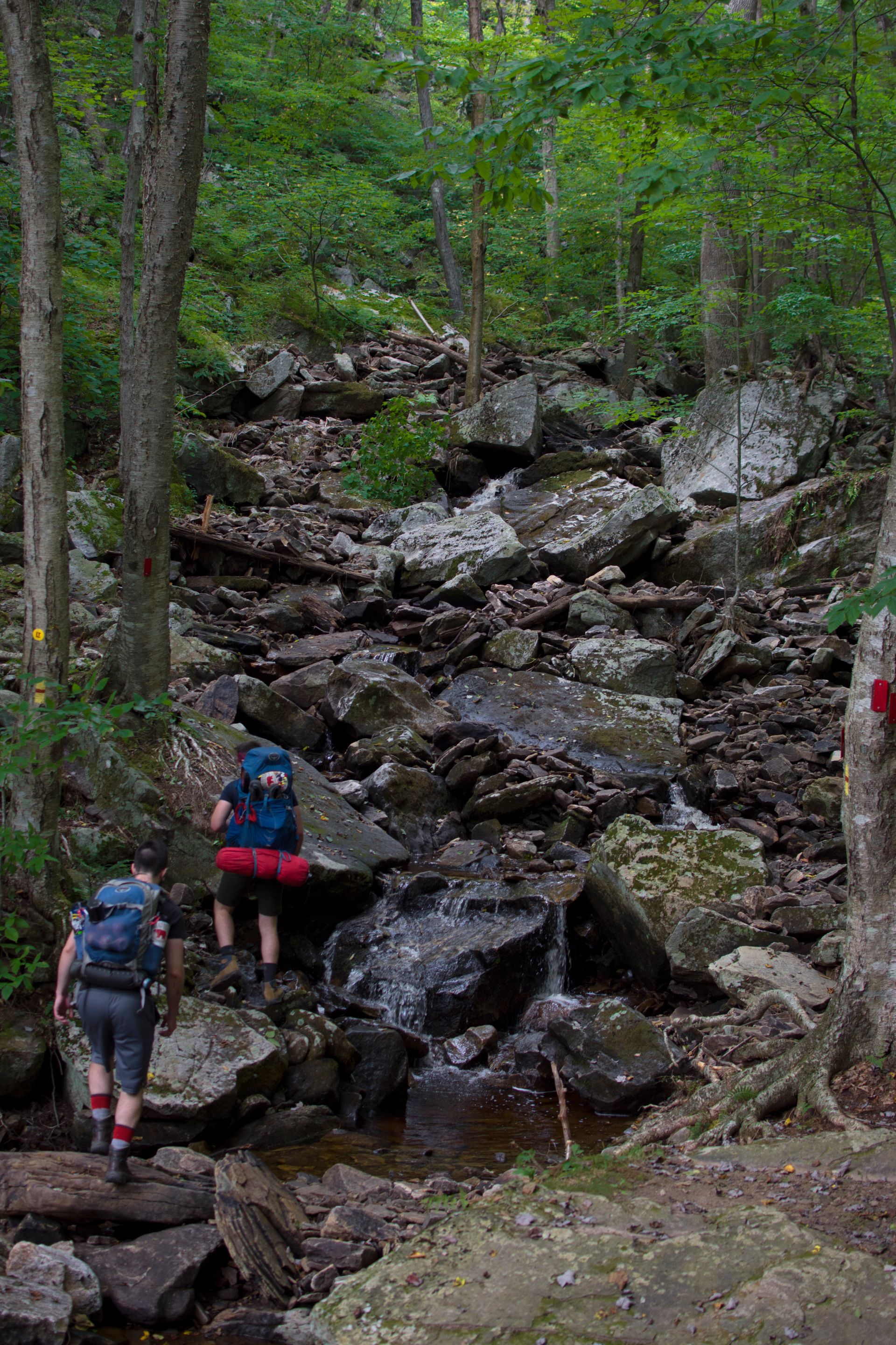
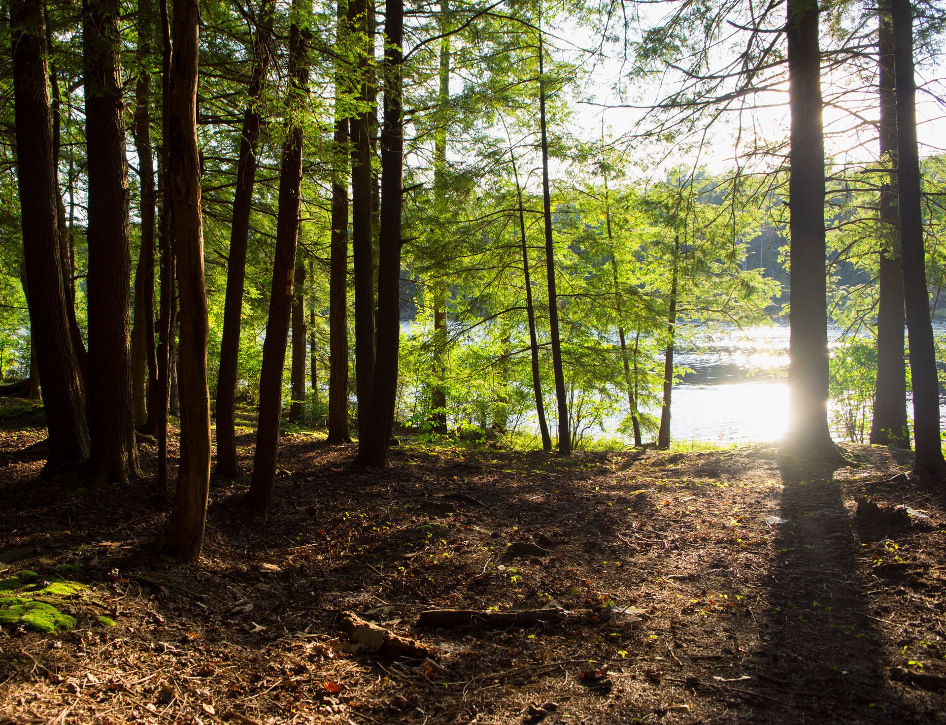
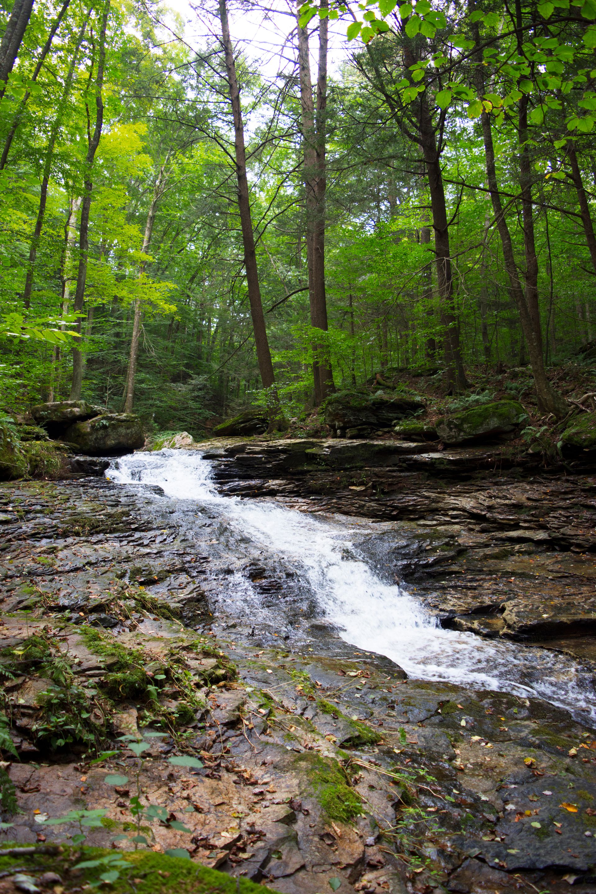
The trail crosses several old logging roads and small creeks (no wading needed for the water crossings). This section personifies the phrase "A walk in the woods", for there is no better example in the country of the simple and easy meander through the colorful forests of Pennsylvania.
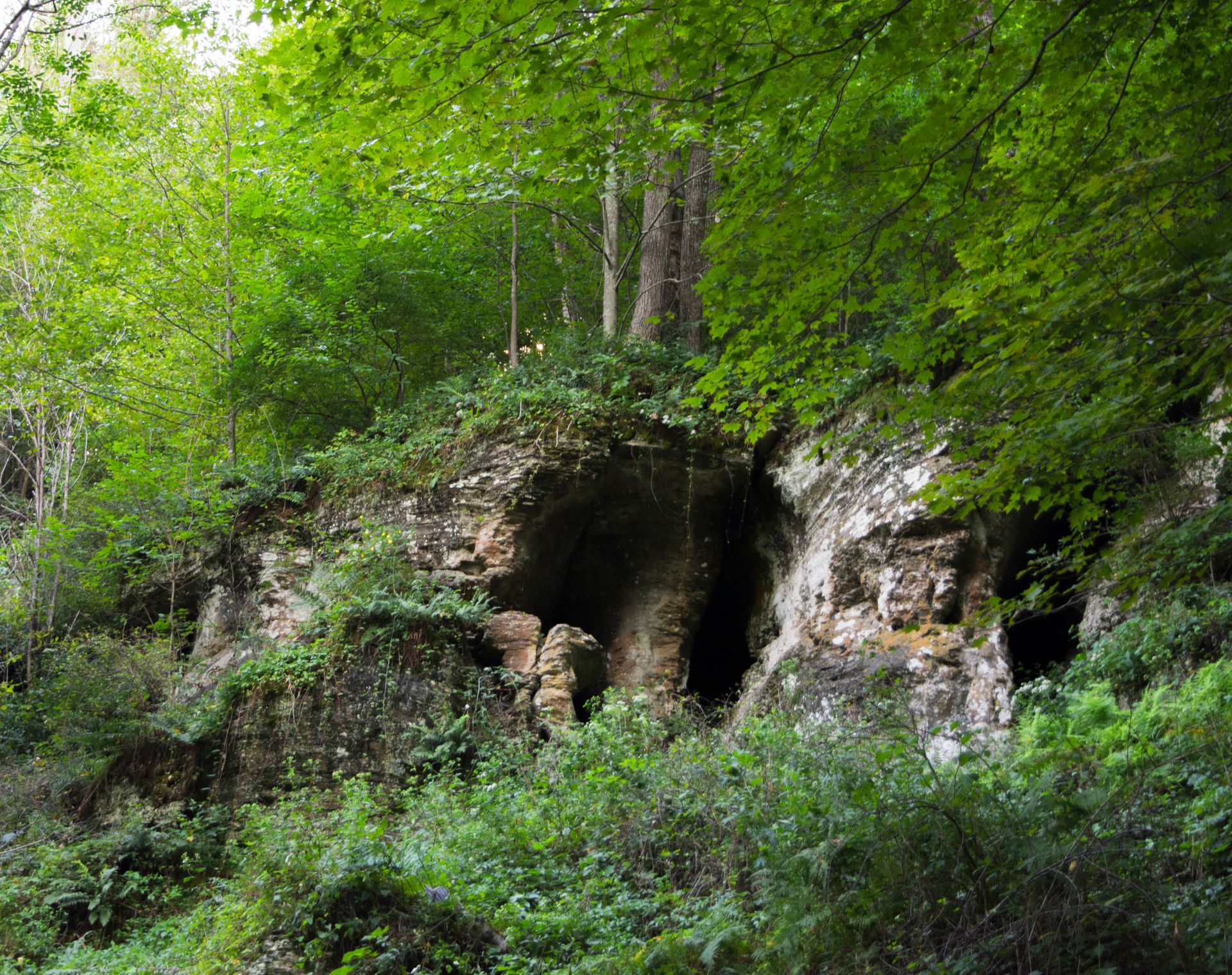
I found myself slipping in and out of a hiking coma, I wouldn't even notice I was walking at times. It is the perfect environment for a soliloquy. If you pay attention, you'll find some interesting rock formations along the way. Appalachian mountains are some of the oldest in the world. What you see left is a true testament of stubbornness of stone.
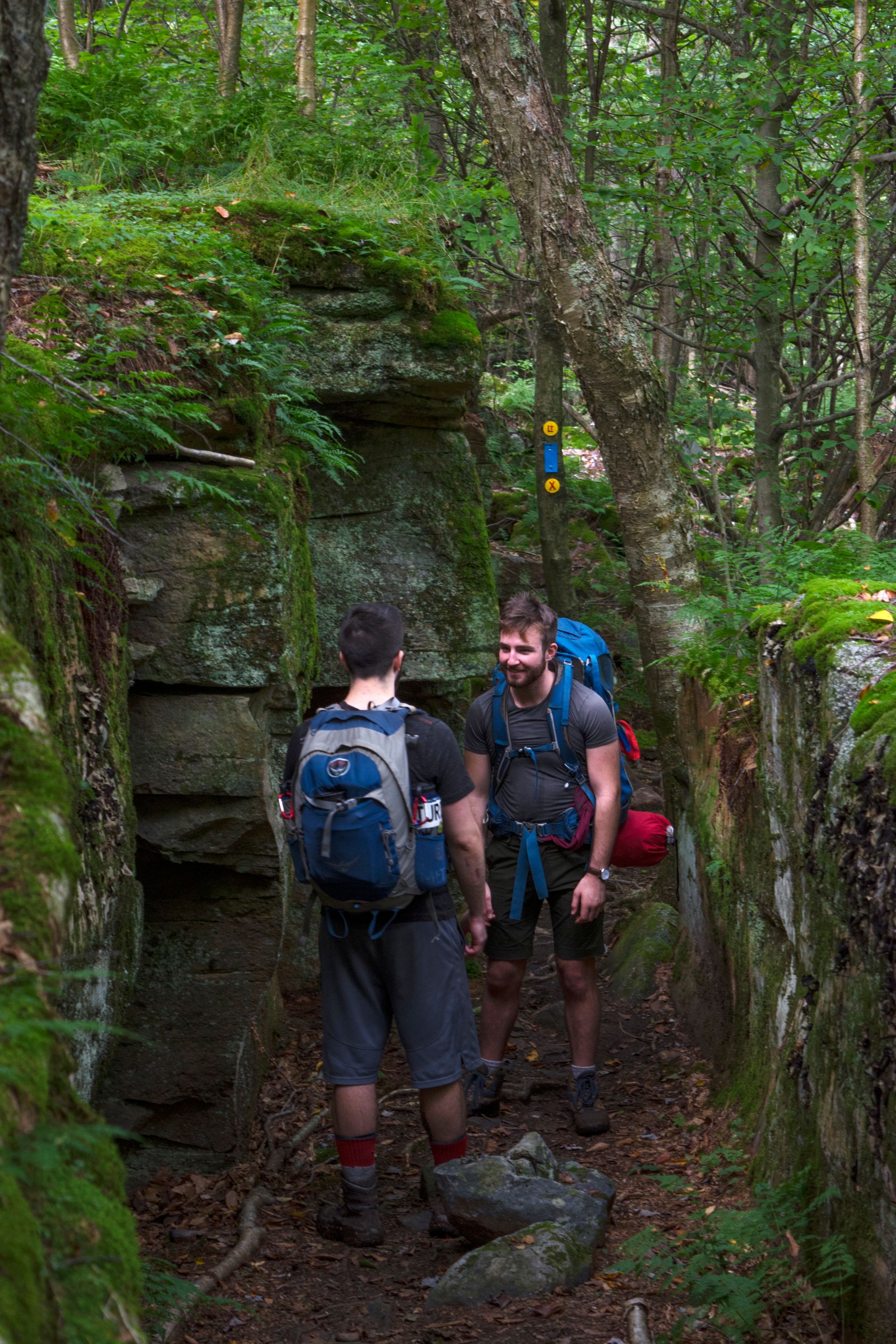
Again, different from the West, you'll have to pay attention to appreciate what's hidden in the woods. If you look close enough, you might be able to find some shallow caves through the dense foliage.
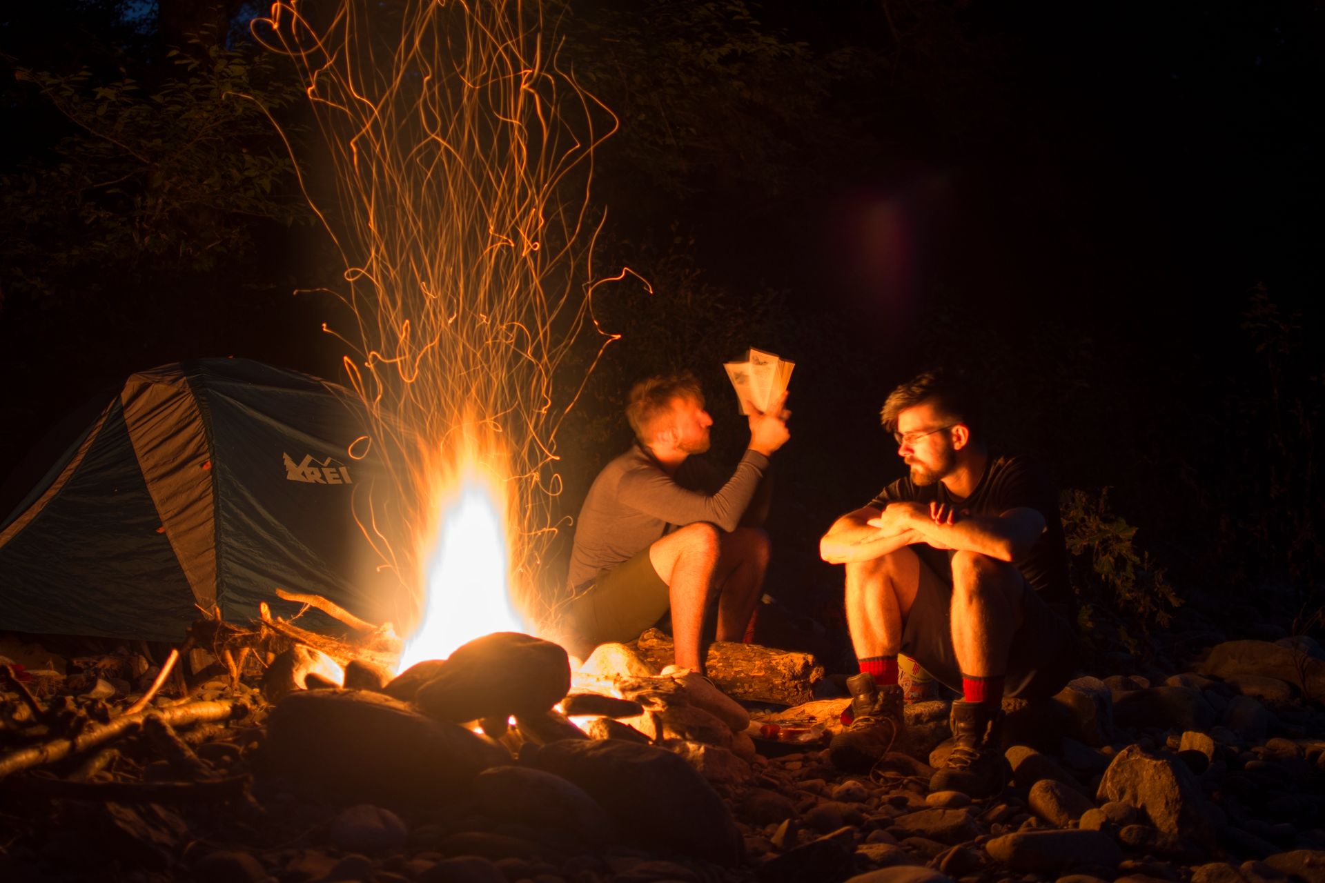
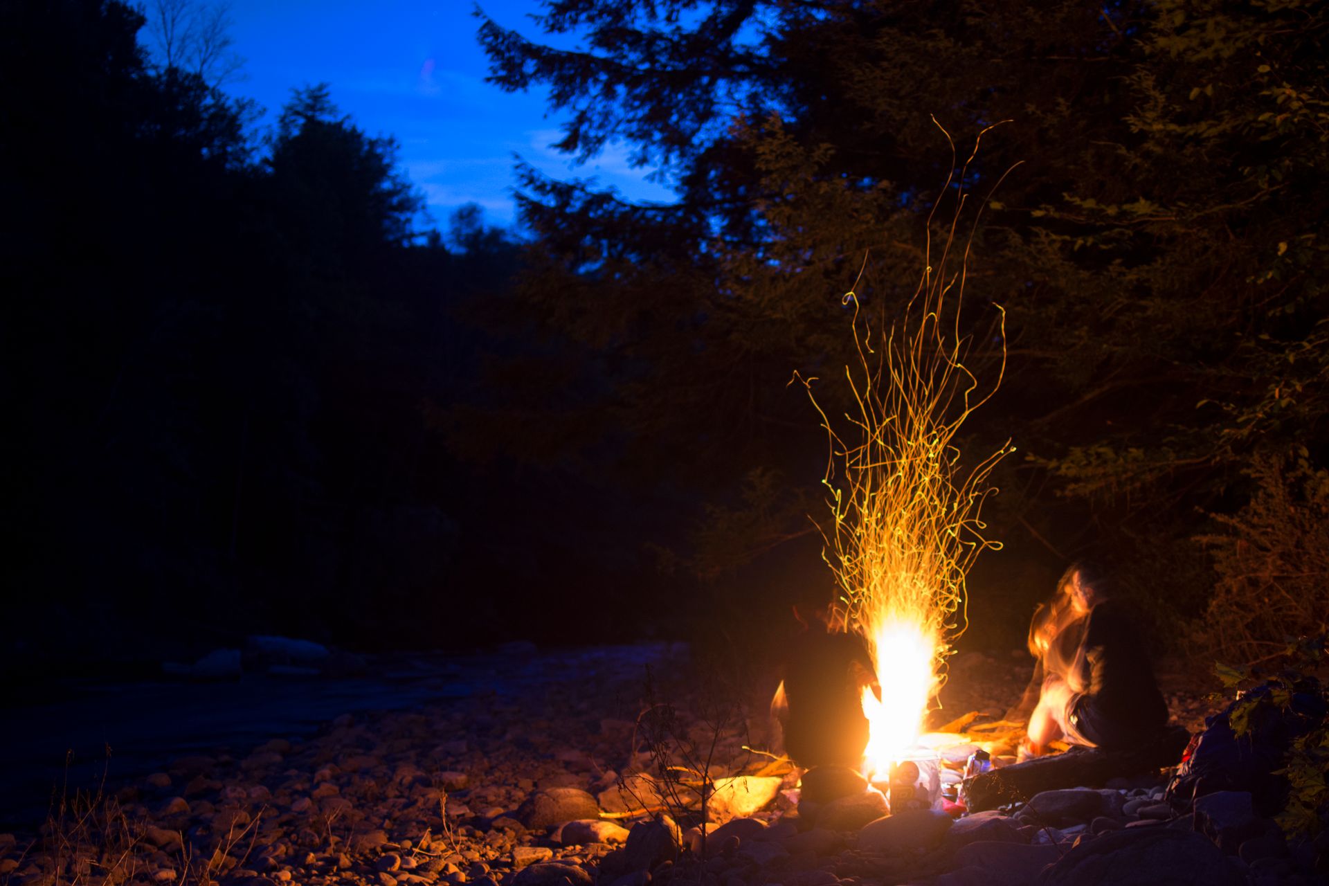
The trail will continue up and down some hills until you reach Sone’s Pond. The pond is beautiful at dusk and is just big enough to still feel secluded despite being fairly close to a service road. I have only ever met a few people at the pond, which is surprising seeing as it is one of the biggest in the area, and such a fantastic area to camp. There are several campsites along the bank of the pond, with most sites having established fire pits.
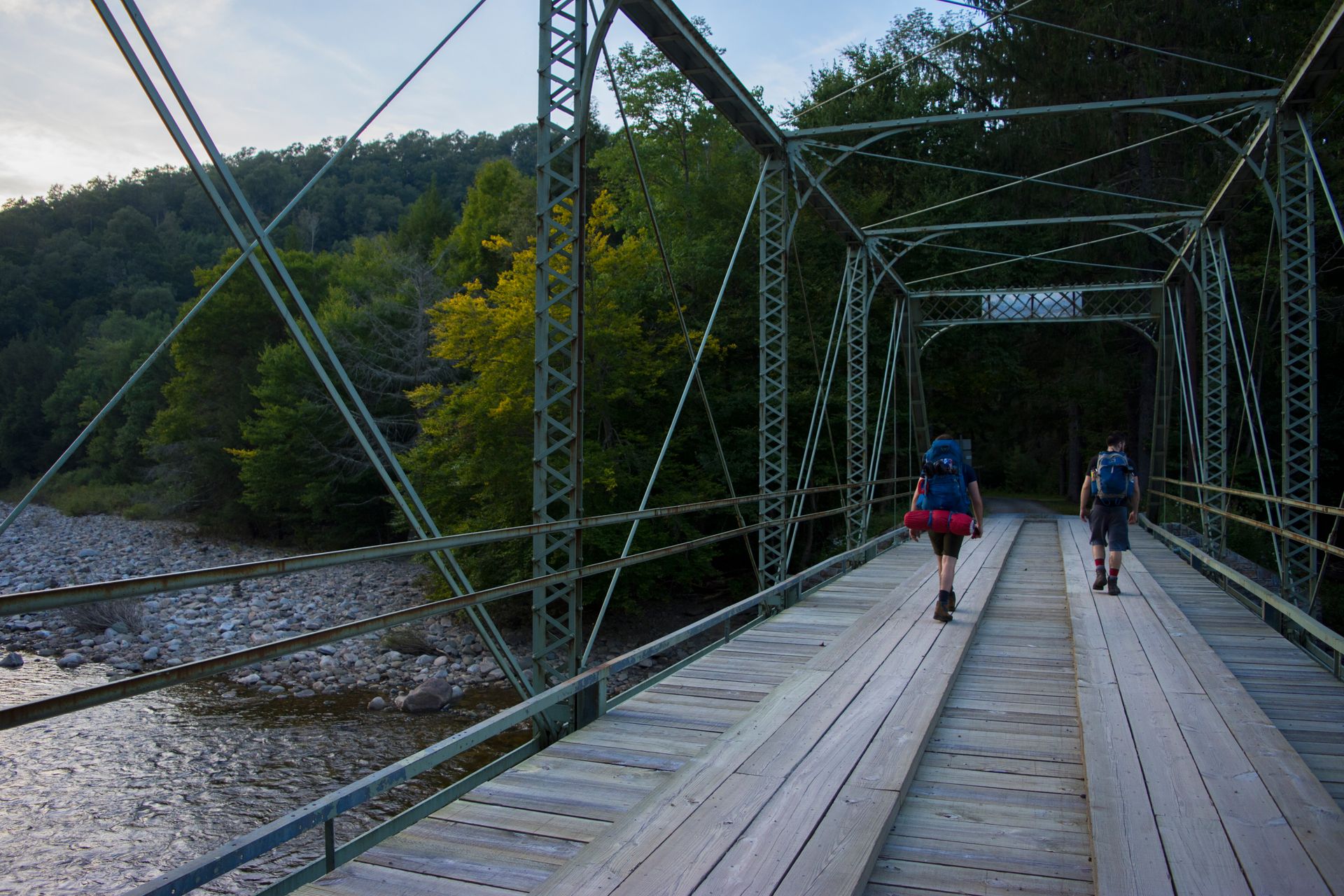
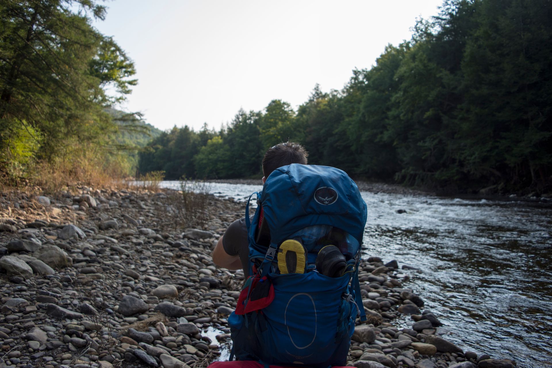
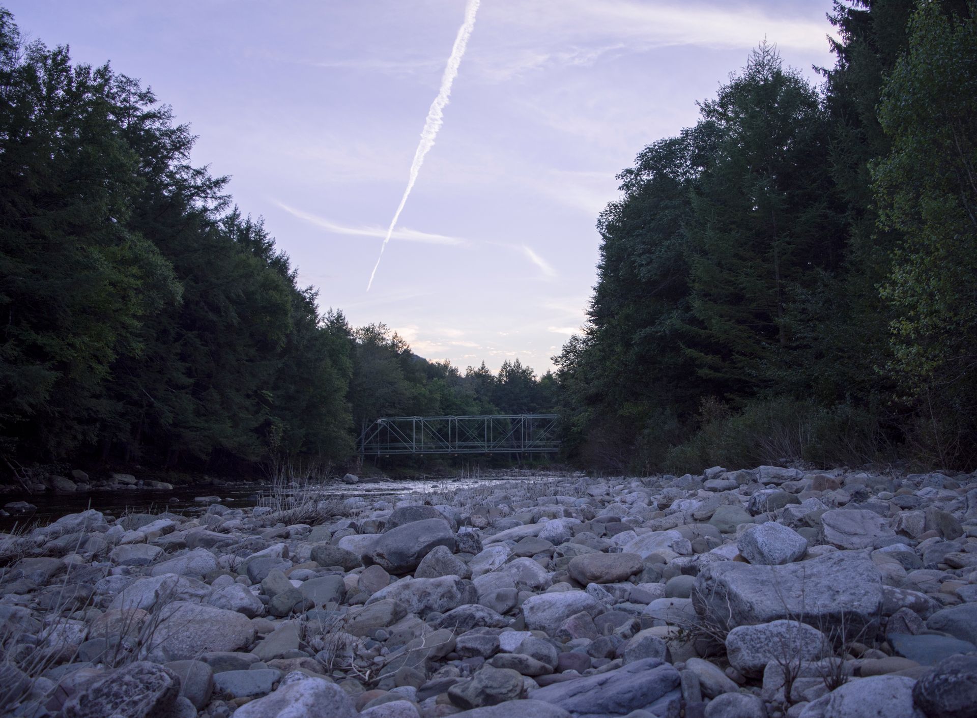
The next indication on the map is the Iron Bridge, an old logging bridge that is still sparsely used today. The Bridge makes for another great area to set up camp if you have some gas in the tank left to hike a few more miles. On this particular trip, we set up on the bank of the river a few hundred yards down from the Iron Bridge. Luckily water levels were low, allowing us to set up far enough away from the water, but out of the tree line and on the silt of the dried up river.
The Haystacks
The Haystacks are another ideal location for setting up camp for the night, which I did the first time I hiked the trail. It is almost exactly halfway through the 25 miles and is, in my opinion, the ‘destination’ spot for the entire trip. Continue following the LT over the Iron Bridge, from there it is about another two miles to the Haystacks.
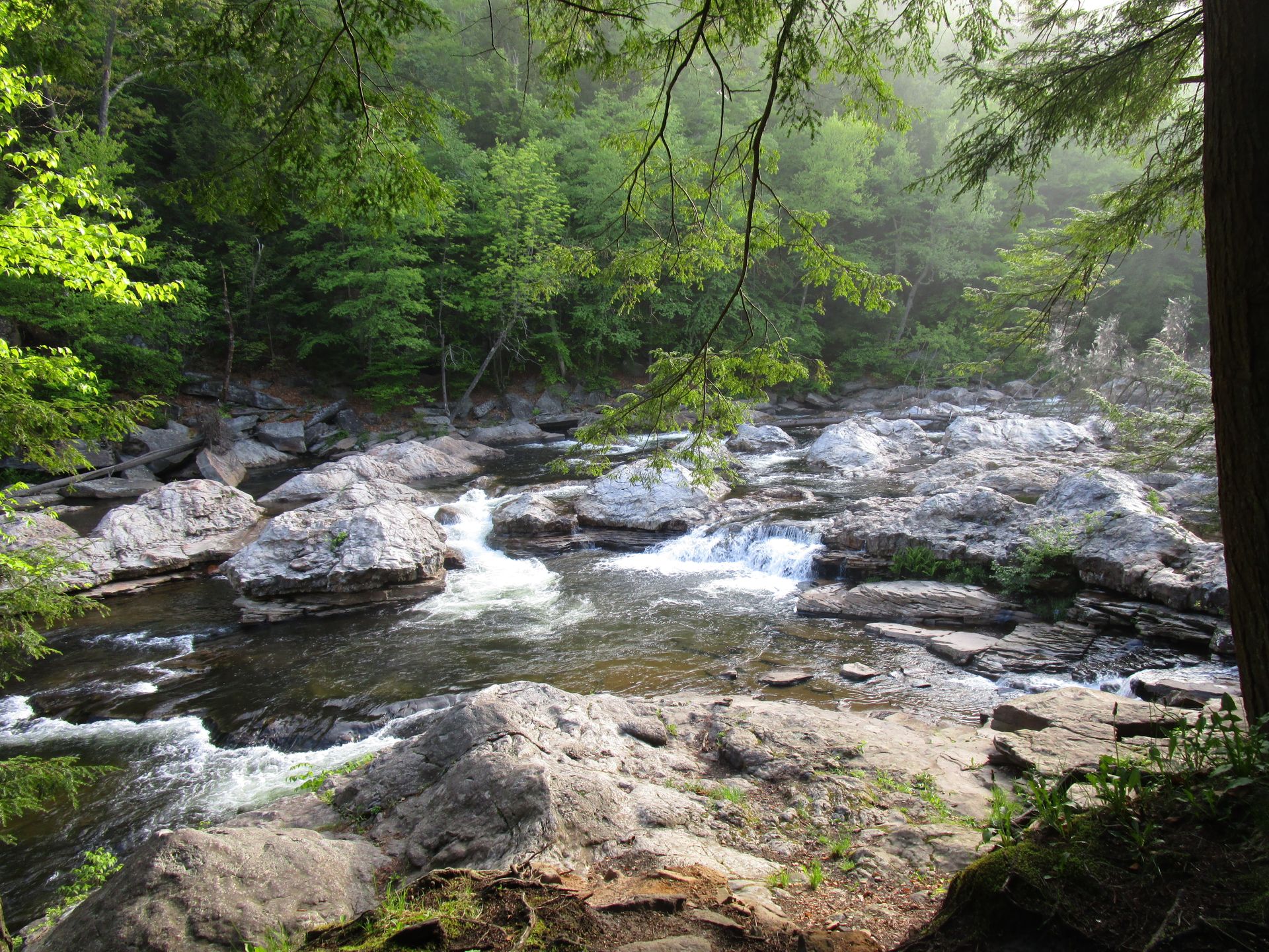
The Haystacks are oddly shaped rocks in a section of the Loyalsock River. For only a few hundred yards the boulders in the water resemble...well.. Haystacks. I have never seen anything quite like it anywhere else, and while it isn’t like some marvelous rock formations out west, it's a still a lovely spot. There are various camping sites along the river, making a very comfortable place to set up camp. Keep in mind that fires at the Haystacks are prohibited, unlike the rest of the LT where fires are allowed.
Hiking Haystacks to Canyon Vista
The next morning you have another choice. You can turn around and head back to the Iron Bridge where the LT meets with the Link Trail, or you can walk down to the Dutchman Falls before turning around. Due to time, we turned around at the Haystacks and headed back to the World’s End Visitor’s Center.
Once back over the Iron Bridge, follow the ‘X’ markers. This trail links back up with the Loyalsock Trail proper, turning the tail end into a loop. The second half of the hike is gorgeous, and follows various streams through the forest while you hike up and down a few more hills.
This section of the trail weaves between bright green oak forest and dark and quiet woods of pine. Some areas were so quiet I could hear my heartbeat while I was walking, and yet other spots were extremely claustrophobic with young pines and saplings just barely taller than me.
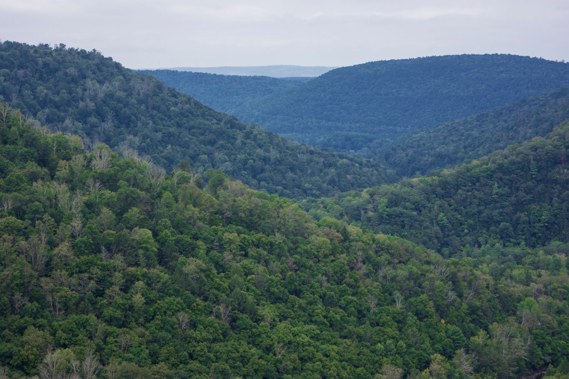
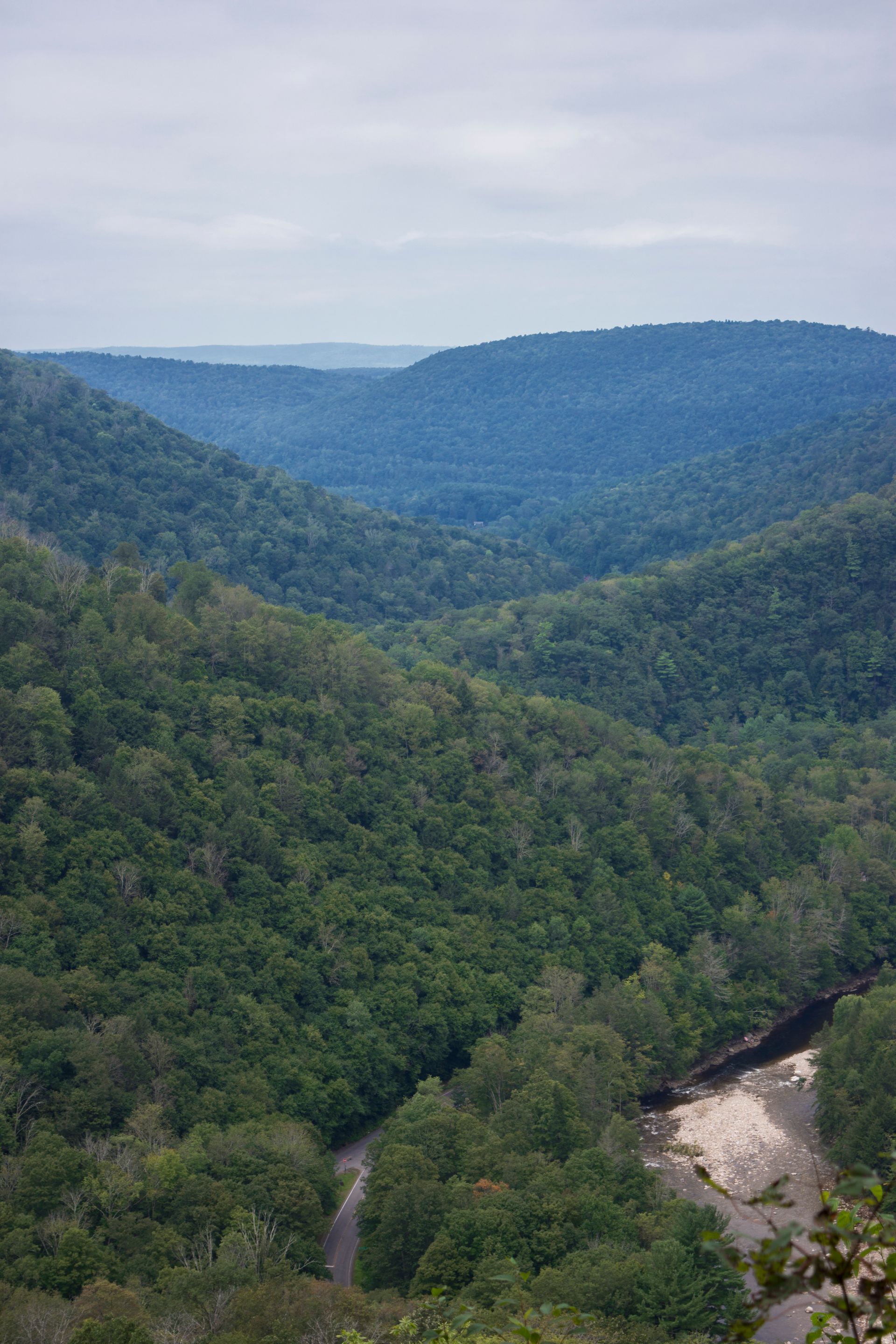
About a mile before the end of the trail, you come across some of the most impressive views on the trip. Starting with the Canyon Vista, which is one of the best views of Pennsylvania hills in the entire state, and ending with one of the prettiest hikes in the state.
Only rivaled by the neighboring park, Ricketts Glen, the last half mile of the Loyalsock Link Trail is one most beautiful secrets hidden by the forests in Pennsylvania. The trail follows the Mineral Spring Stream down the hillside. Flowing waterfalls and cold pools tumble down steep rock cliffs with you on your descent. The entire path is lined in tall, limbless oak trees, giving an open yet covered sense. While I normally retain the Lord of the Rings comparison to western mountains this stretch of the trail looks like Rivendell.
From here, the trail remains on the banks of either the Loyalsock River or branching streams feeding into the river.
There is plenty of water on this hike, you will probably only need one, maybe two water bottles, and make sure to bring a water filter. Feel free to leave behind the extra camel bags for this hike!

Reflection
Before my experiences out West, I would have categorized the Loyalsock Trail as difficult, but knowing more now, I would say it is moderate. You aren’t fighting the elements elevation brings with it, such as bad weather or shortness of breath. There is plenty of water which isn’t true for a majority of western hikes, and there is no real climbing needed.
All that being said, I would place the Loyalsock trail as one of my favorite hikes to date. Maybe it is because I am biased towards Pennsylvania, but I believe it is more than just loyalty to my home state. There is something fundamentally simple and beautiful about the land. The forests feels old, the trail is comfortable, the climate is moderate, the streams cold and refreshing, the songbirds loud, the saplings bright green, and the ferns fuzzy. You can really relax on this hike, knowing it is relatively safe and comfortable.
Throughout my childhood I dreamt of living in one of the frontier states in the shadow of the Rockies. I took part in the regular complaints of the state I was living in, how it was ‘naturally boring’, and never once stopped to appreciate what I had right in my own backyard. Although I am still amazed when I see the Rocky Mountains, and I can’t quite believe that some lucky people get to see the snowy peaks every day, I have come to love the green hills of Pennsylvania and New York. Nowhere else in the country gives me that home-y feeling of this area, and I feel lucky that I get to appreciate both the mountain states as a visitor and the Eastern states as a resident.