"You may know exactly where you are; yet be completely and utterly lost"
Kurt Walck - May 22, 2017 at 10:43am HST
This was the exact moment it all started. A simple text no more than a 10 second read was enough to ensue 9 months of planning and even more so, 9 months of holding our horses.
The King Range NCA
"The King Range National Conservation Area (NCA) is a spectacular meeting of land and sea as mountains thrust straight out of the surf with King Peak (4,088 feet) only 3-miles from the ocean. The King Range NCA encompasses 68,000 acres along 35 miles of California's north coast. The landscape was too rugged for highway building, giving the remote region the title of California's Lost Coast. It is the Nation's first NCA, designated in 1970." - According to the Bureau of Land Management.
What the Bureau of Land Management fails to mention in the King Range's bio is just how "lost" the region is. For perspective of this, the nearest gas station was a minimum drive of an hour and cellular reception was pitiful; the latter being a blessing to the few who seek it, like Kurt and myself.
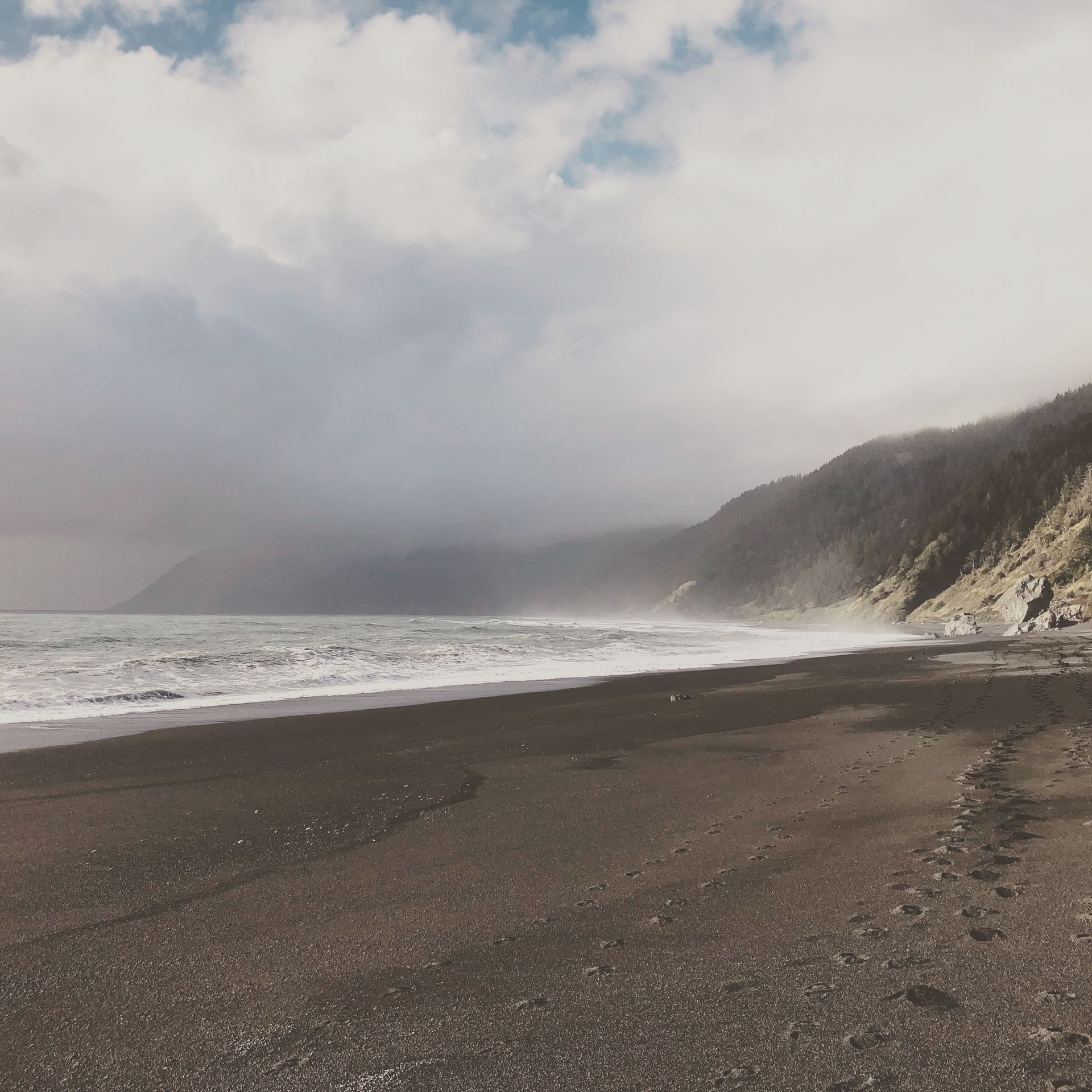
The Lost Coast Trail is a 26 mile stretch of the 35 that the King Range coast line encompasses. With nearly untouched beauty, these miles were to be our home for three days. It's starting trailhead for south-bound hikers lies at Mattole in the north and the ending trailhead at Black Sands Beach to the south.
Preparation
Once Kurt and I had settled on hiking The Lost Coast in Northern California's King Range National Conservation Area (NCA), it was all rather easy. All we had to do was find the time that both could meet for the week. Kurt, a 6'6" pre-pharmacy student at West Virginia University knew that his best and really only opportunity for such a trip would be during his '17-'18 spring break. While his peers would be going places like Cabo or Miami Beach, he had other plans. Very, very different plans. As for myself, this was easy. I would take time off from my job, a carpenter for a small real-estate development firm or as it would work out, I had left the job the month before giving me limitless availability. Oh yeah, I also live in Hawai'i, which would make communication with Kurt due to the 5 to 6 hour time difference a real joy said sarcastically.
During this period of time that we planned the trip I would book the rental car through Turo (a peer-to-peer car sharing service; which I prefer far above that of a professional service), as well as take responsibility for the accommodations during our stay in San Francisco which was to be our port city on the west coast. Kurt was to reserve the backpacking permits needed to stay overnight in the NCA. The last thing to plan for was a transport to drive us from the ending trailhead where we'd leave our car, to the start. This task would fall on a friend of ours, Abbie, who had gone to high school with Kurt and had now lived in northern Cali for several years.
The Journey
I would fly into San Jose from Honolulu on March 9th and stay the night at a friends, then pick up Kurt from SFO early the next morning and begin our journey to Petrolia. This of course was not to be done without making a needed pit stop at REI (an outdoors mans paradise) for stove fuel and food, and then a final stop at In-n-Out for our personal belly refueling. The next 5 hours that was to be our drive (in the 2016 Toyota Prius we rented - which was a great road-tripping car at 54 mpg's) to Shelter Cove was filed with beautiful views and a building excitement.
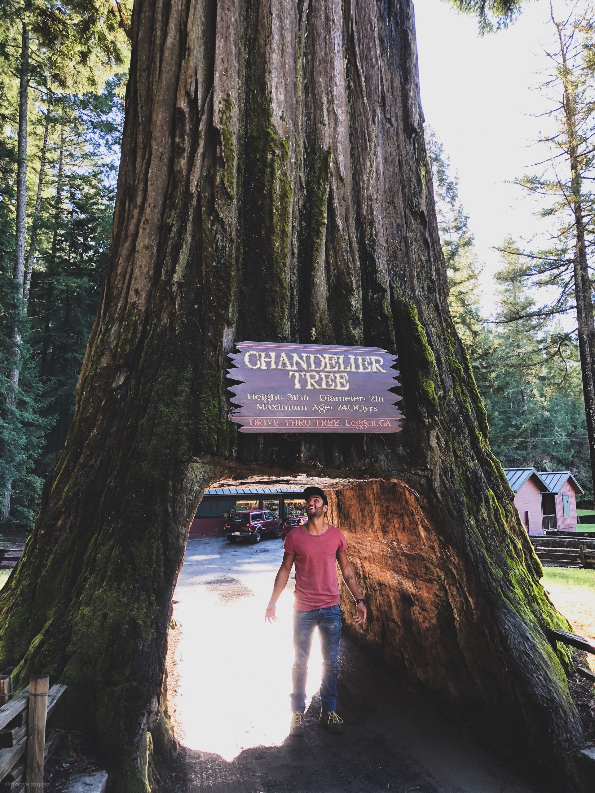
On the way we would would detour for a trip to Chandelier Tree, a random bridge high over a valley, and coffee - the best damn coffee I've ever had. We would arrive at Shelter Cove around 18:00 where Abbie and her friend were awaiting our arrival. Kurt and I would transfer ourselves and packs to her truck and begin the shuttling around 18:30.
About an hour into the 2.5 hour drive to Petrolia I had asked Abbie how she was on gas, her reply; "about a quarter tank, maybe a little less. Think we can make it?". Now, me knowing that a 2nd generation Tundra would maybe get 18 mpg (on a good day) would get no where close to that on the very hilly dirt roads that would take us to our destination. I quickly told her that we were NOT going to make it the distance let alone her and her friend make it out and back to refuel for their own journey home. Luckily within minutes of this conversation a vehicle was approaching from the other direction. We would stop and wave them down to ask "we're tryna make it to Petrolia with a quarter tank of gas, can we make it there? If yes or no, where's the nearest gas station?" to which the man, Jebidiah, replied "youse better turn 'round and head back to town. Be lucky to even make it back". Armed with his wise words, we would head back faster than a squirrel can climb a tree.
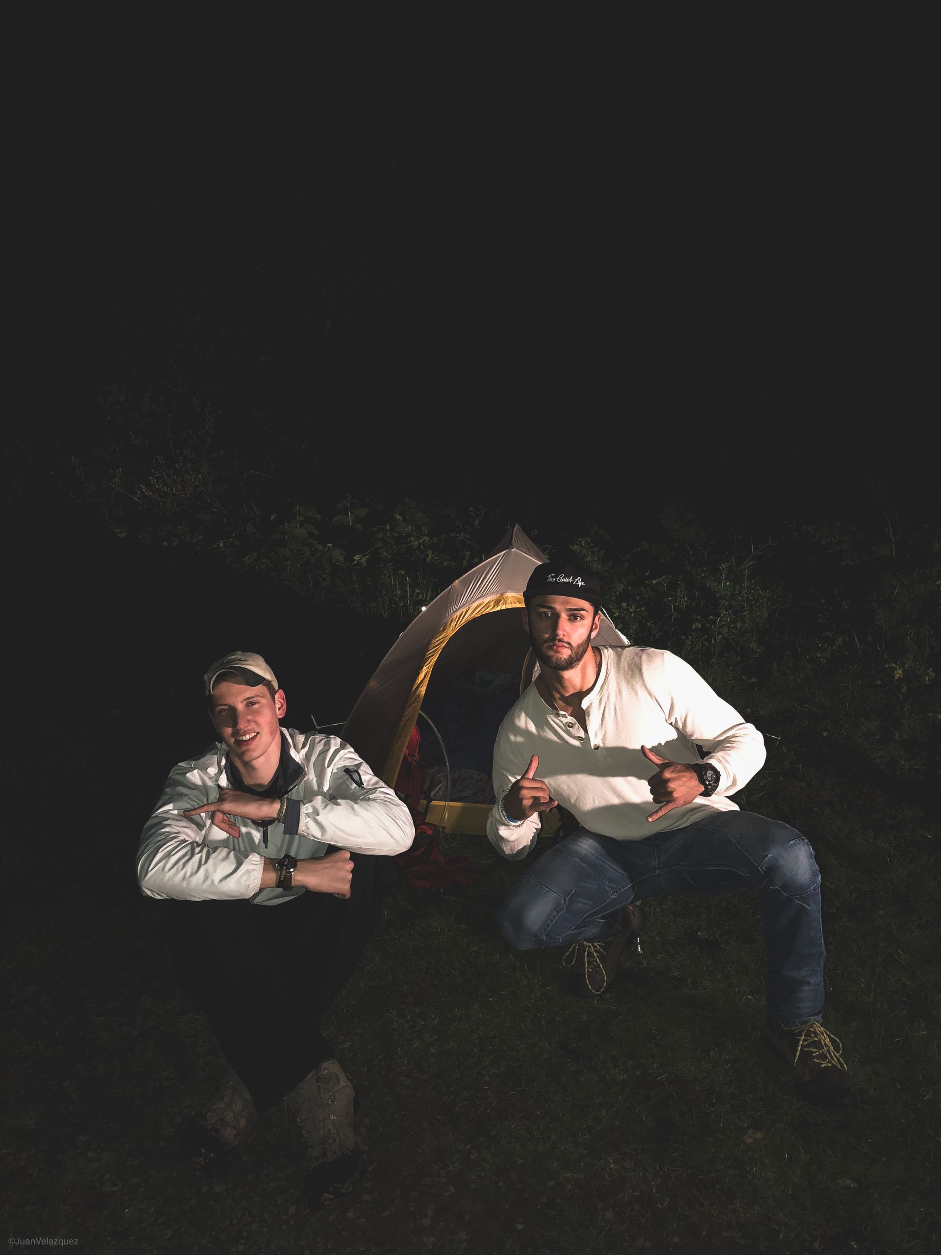
We made it to the gas station. Just barely. But the time was now 20:00 and it was still a 2.5 hour drive to the trailhead. The little hope Kurt had of setting up camp the starting night on trail was now no longer there. I would take over as driver for the second attempt so that Abbie would have a chance to relax and prepare herself for her own trip home that night; another 5 hour drive. We arrived with good time around 22:00 and against standard but with knowledge of an early morning, would set up my tent in the headlights of the truck just off the trailhead parking lot in a patch of grass. We said our thanks, followed by goodbyes and a "drive safe". We watched as Abbie and her friend drove away, then turned in for the night.
The Trail
I'll write this up quickly because while it's the reason for this piece, its the simplest to tell. Also, to be honest, no matter what conditions the weather is in, it's beautiful. However that being said, the weather was shite. Cold and damp air, rainy, highly overcast, and windy. Still beautiful in it's own right though!
Day 1: Mattole to Sea Lion Gulch
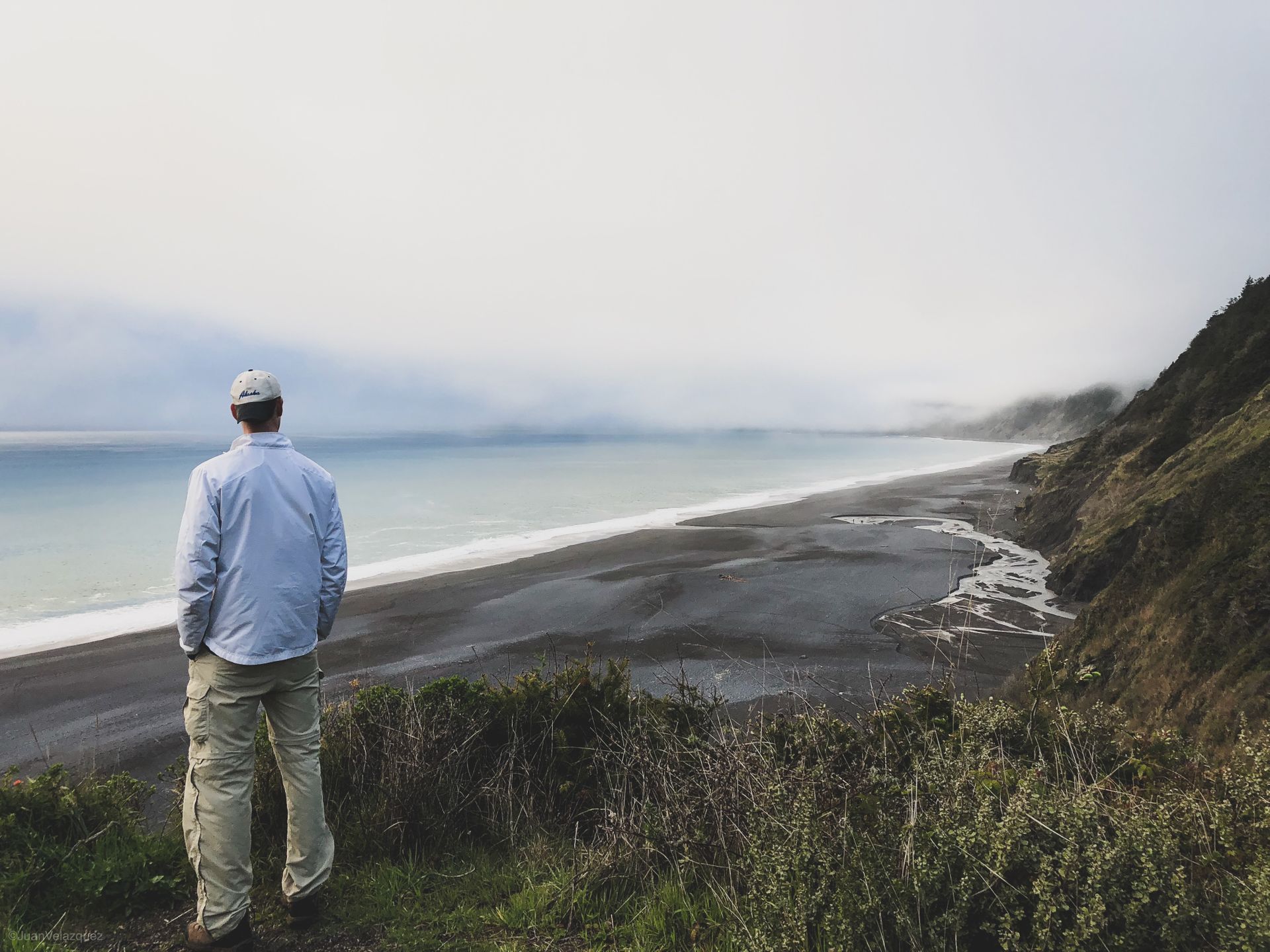
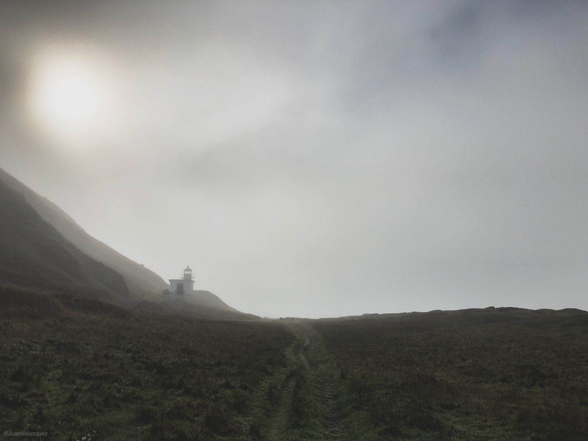
Easy Day, about 5 miles and filled with beautiful views. This would be our first taste of coastal backpacking and more importantly, what it'd feel like to trek on the sand, gravel, and sandy dirty gravel. To be honest, this first stretch isn't much to talk about until you arrive at Punta Gorda Lighthouse - a very interesting history to read about. Not only is this build a historic one read about it here but it's also surrounded by beaches filled with sea swimming dogs (sea lions). From here which was only about 3.5 miles from the trailhead, we continued on to SLG, another 1.5 miles. We set up camp off trail on a bluff and as we did, the sun poked it's glorious beams of light on us. We would take naps basking in its light, in our boxers, listening to the swimming dogs perched on boulders doing the same. Kurt would eventually get quite the facial sunburn from this and it would be almost the last of and only bit of sunlight we came across. Oh yeah, and we (my fault) packed too little food for us.
Day 2: Sea Lion to Big Flat
This would be the "disaster day". Not really. It just rained/misted all day soaking us and most things we had not in dry bags (the backpacks themselves, our boots, bones, and spirits) and would be the day that Kurt and I both became plagued with poison oak. We started the morning with a game we like to call the waiting game. See, this trail being a coastal trail, primarily on the beach, in a place dubbed "The Lost Coast" due to its remoteness and harsh water-shaking hands with-cliff sections, has two areas about 4 miles long that are only passable during low tide. Anyways, low tide being at 15:30, and waking up at 08:00 allowed us much time to reflect. So, knowing that I had packed too little food and that we needed to be out in two days or less, we headed off on the receding tide about 14:00. This would be a 10 mile day that had many stream crossings and the eventual (probably) poison oak contamination. There was a small break in rain and a perfect thicket of small pines, a stream, and clearing nearby that we decided to set up camp. It of course started to rain again while setting up however that didn't stop us from eating dinner and then continued very heavily throughout the night.
Day 3: Big Flat to Black Sands Beach
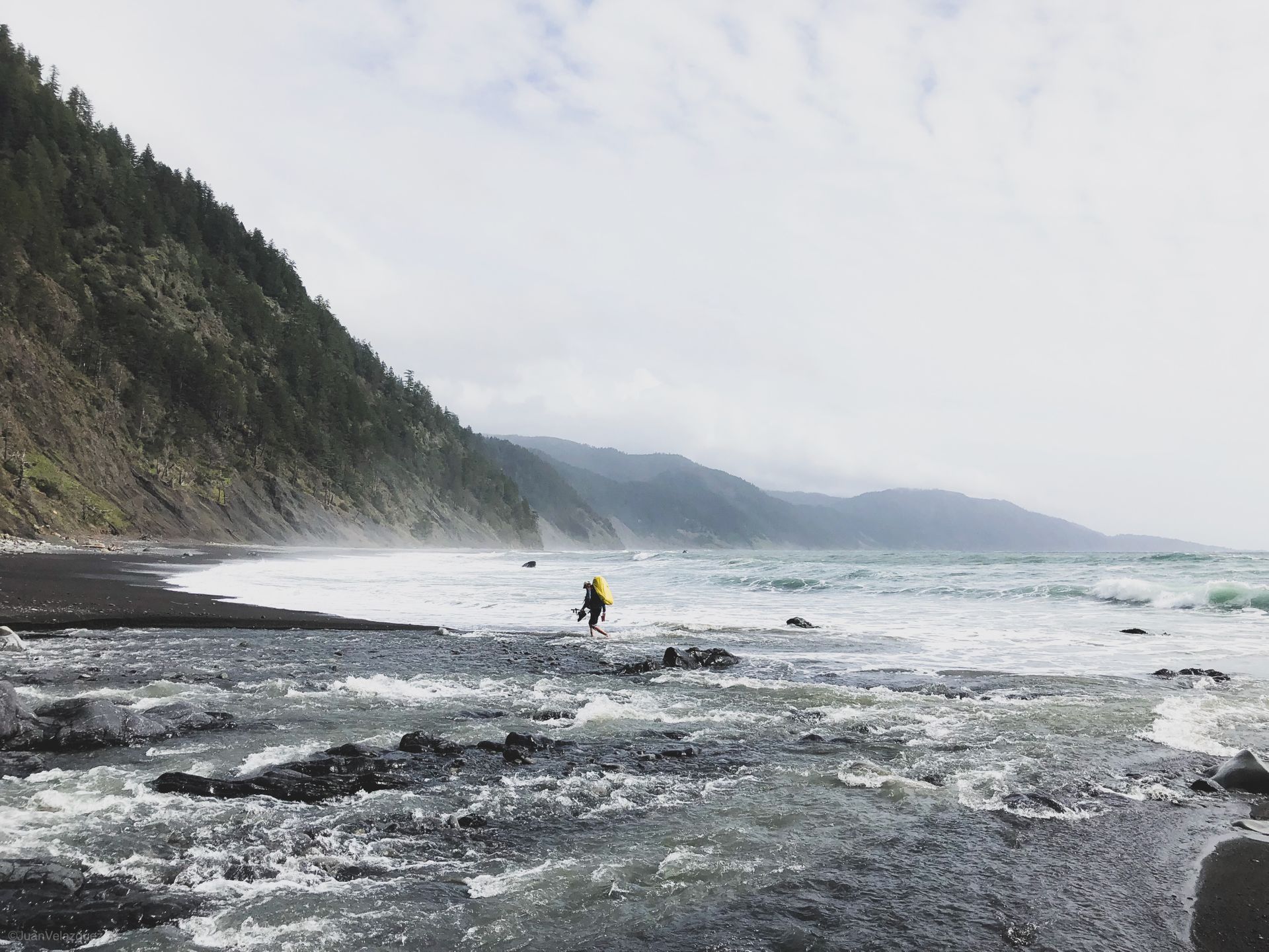
This would be our final day. We would wake up to no rain, minimal wind, and a rather calm sky. We were pleased. After breakfast and packing up, we headed off. During a stream crossing, which Kurt nearly fell into the balls-deep water and was almost carried off to be a merman, we met a man who I shall not name but whom we would stop and chat with for a brief while. He was on a week long break from work to clear his head after losing his son six months prior. For him, this solo journey was about accessing and becoming friends with the grief rather than letting it get the better of him. As we parted ways, he asked that we send his wife a text when we reached cellular reception telling her that he was safe and heading home in a couple of days. We still had nine miles of beach left to hike. nine miles that would take us but six hours (including two long stream crossing breaks and two lunch breaks). We would arrive to our car just before nightfall and make a pitstop at a nearby pizza shop/lodge for food and beverages. Both were delicious. Then, during the darkness of night, we would leave just as peacefully as we arrived but unlike our arrival, we would now have an unforgettable experience to take with us indefinitely.